Author's posts
May 08
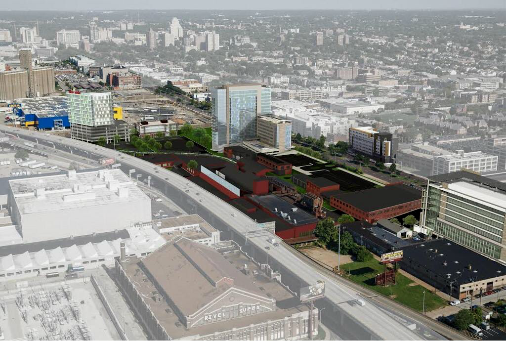
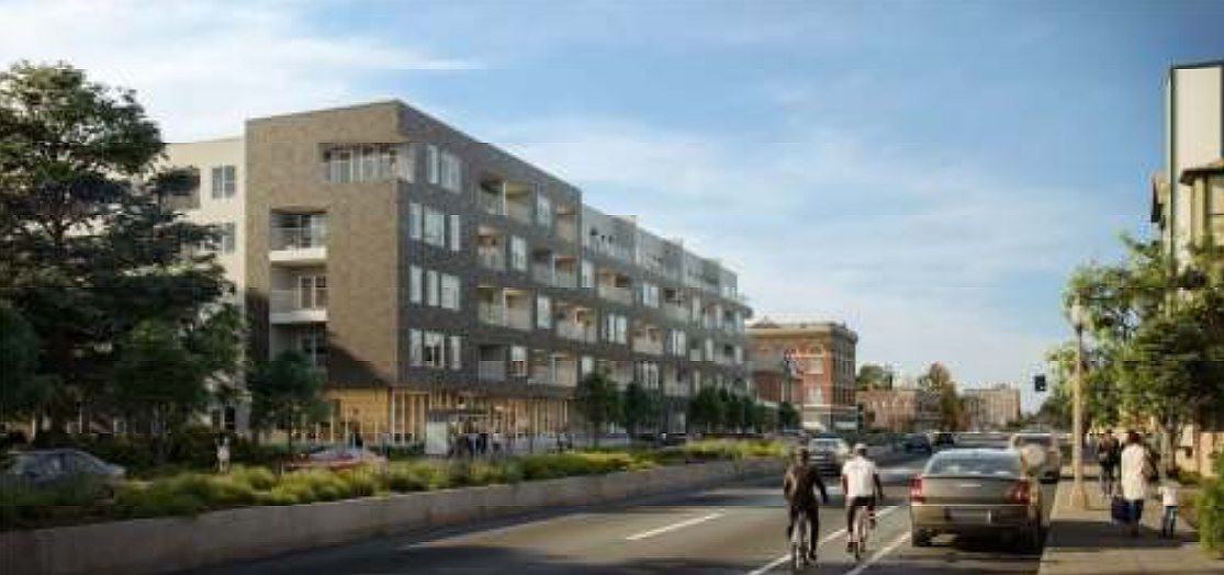
RFP for Chuck Berry Museum and Cultural District Issued by City of St. Louis
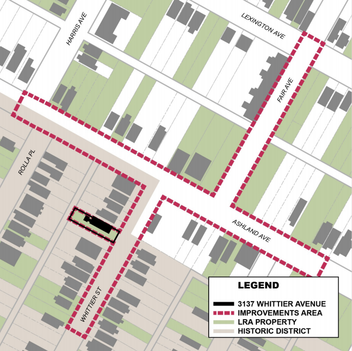
The City of St. Louis Land Clearance for Redevelopment Authority (SLDC) has issued an RFP for what it’s calling the “Chuck Berry Museum & Cultural District”. You can view the full RFP here as a PDF, or read the document as images below. News of the RFP was first reported by St. Louis Public Radio.
Introduction:
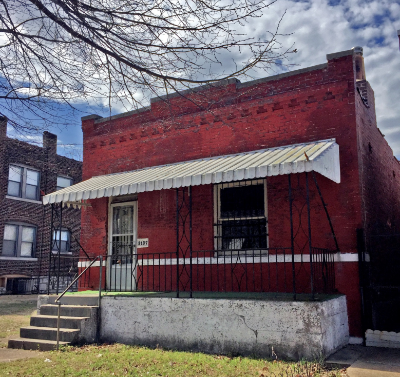
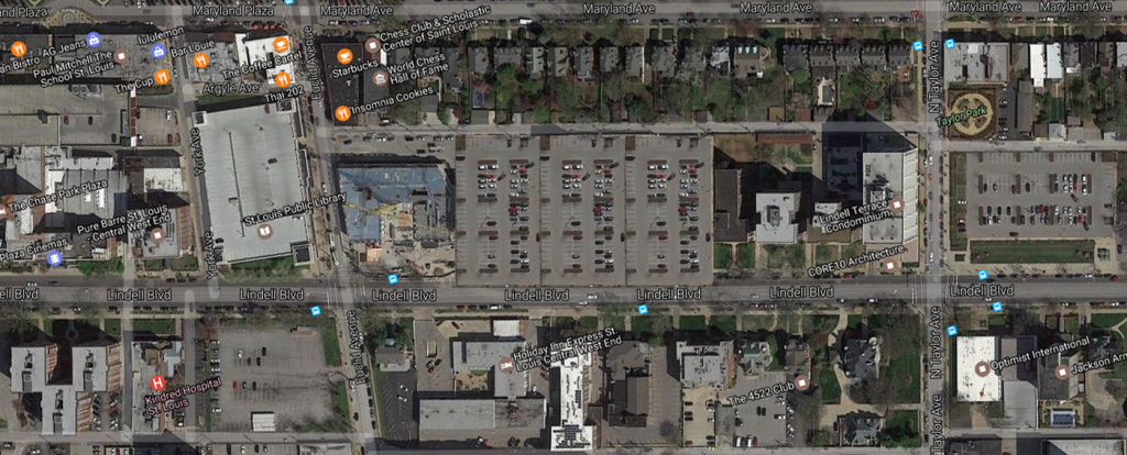
The Land Clearance for Redevelopment Authority of the City of St. Louis (LCRA) is issuing a public Request for Proposals (RFP) for redevelopment of the Land Reutilization Authority (LRA) owned property at 3137 Whittier Street and surrounding LRA properties (the “Property”).
Significance:
There are fewer more well‐known and influential guitarists than the legendary pioneer of American rock and roll – Chuck Berry. His words, music, and lifestyle have shaped the genre as we know it today. And his name is about as “St. Louis” as toasted ravioli, ooey gooey butter cake, or provel cheese. This brief history is provided as an overview of the life of Chuck Berry and the significance of 3137 Whittier Street to the history of rock and roll.
Born in the Ville Neighborhood of the City of St. Louis on October 18, 1926, Charles Anderson Edward Berry was the son of an educated African American woman, Martha Berry, and a skilled carpenter and deacon, Henry Berry. At the time of his birth, north St. Louis was the epicenter of a prosperous and entrepreneurial black community, nestled within a deeply segregated City.
Context and Redevelopment Strategy:
In the mid‐1800’s The Ville was a semi‐rural suburb of St. Louis known as Elleardsville, which later became a part of the City of St. Louis. In the early 1900’s, The Ville became one of the few areas of St. Louis where African‐Americans could own property, and by the 1920’s and 30’s The Ville had become the cradle of culture for Black St. Louis. The Ville not only attracted major Black figures in a number of fields, but produced a disproportionate number of individuals who went on to achieve world‐wide recognition, including Tina Turner, Dick Gregory, Arthur Ashe, Annie Malone, and Josephine Baker. And while crime, deferred maintenance, population flight, and vacancy have resulted in the disinvestment visible today, the area still has many important historic and cultural assets like Sumner High School and Homer G. Phillips Hospital.
Incentive Package:
As part of the redevelopment strategy, SLDC will work with the Respondent, the Alderman, and all applicable boards and commissions to seek and negotiate the following development incentives,
which may include (but is not limited to) the following: Chapter 99 Real Estate Tax Abatement (up to 25 years), Sales Tax Rebate / Development Agreements, State and Federal Historic Tax Credits, Set the PACE St. Louis: PACE Financing, and New Markets Tax Credits (NMTC).
[ Full Chuck Berry Museum & Cultural District RFP (PDF) ]
![]()
![]()
![]()
![]()
![]()
![]()
![]()
![]()
![]()
![]()
![]()
![]()
![]()
![]()
![]()
May 08
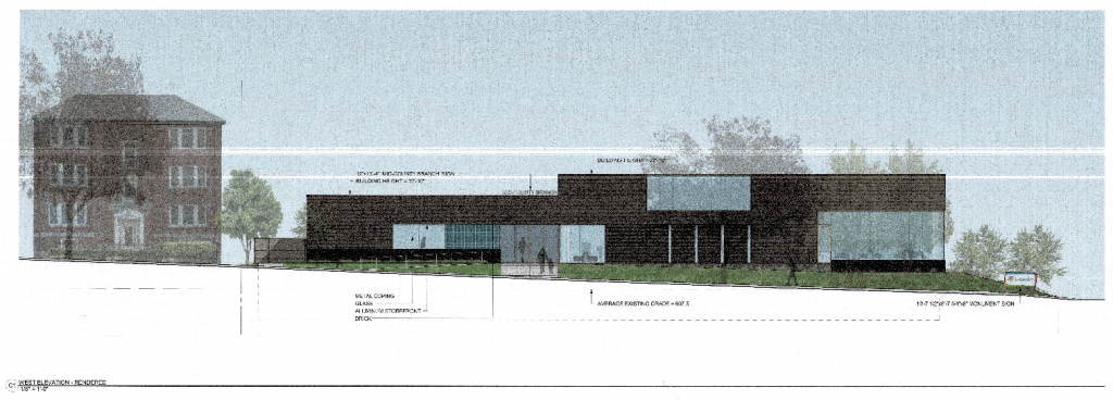
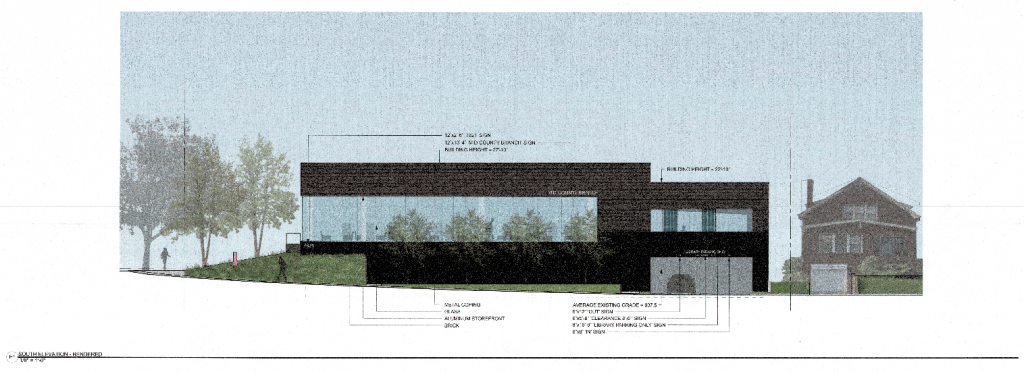
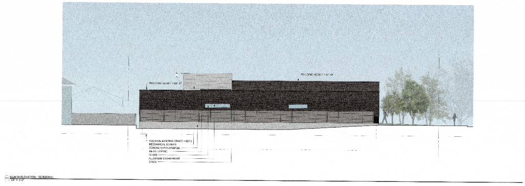
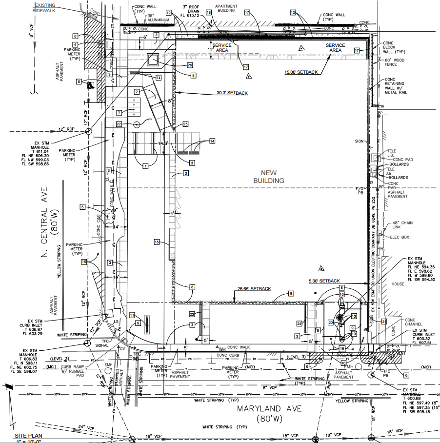
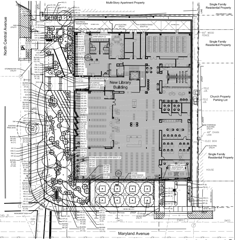
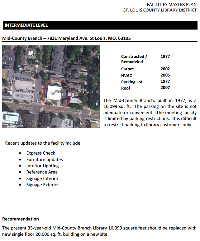
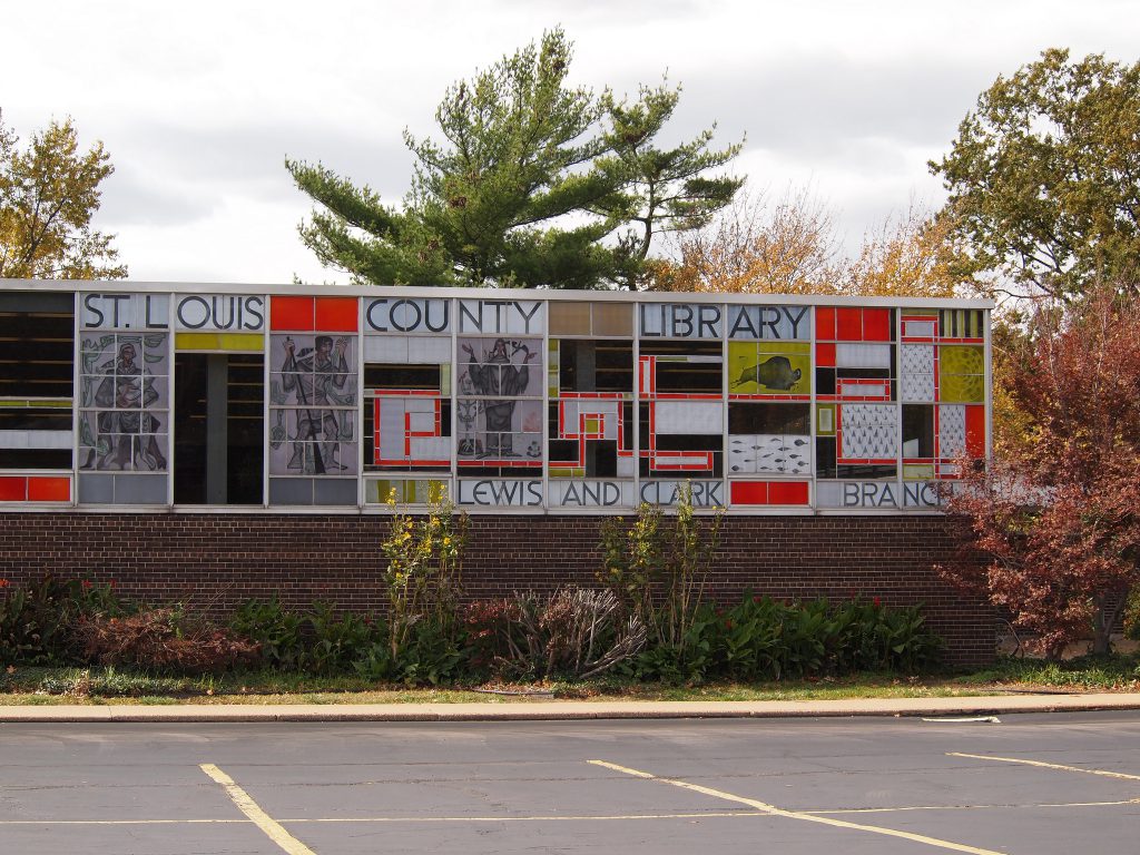
First Look: Demo, Replacement Planned for Clayton Mid-County Library Branch
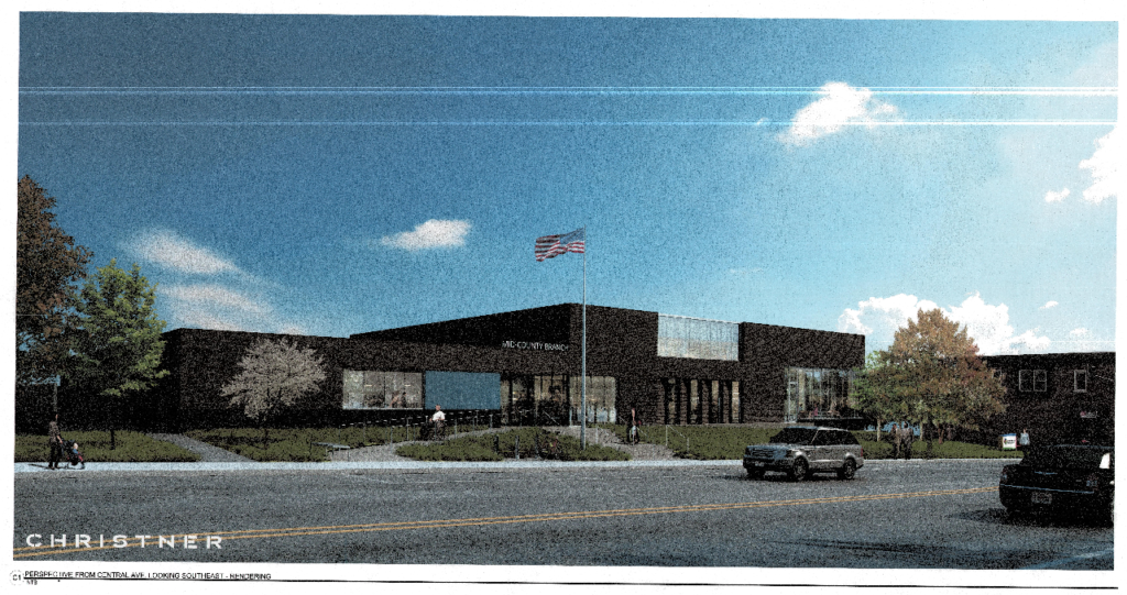
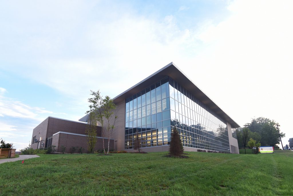
We now have a first look at the $7M replacement for the St. Louis County library’s Mid-County branch at 7821 Maryland in downtown Clayton. Planned is a modern gray brick replacement as part of phase two of the “Your Library Renewed” campaign.
The 2012 master plan produced by the library system outlined plans for the replacement or renovation of the system’s branch libraries. County voters approved a tax increase to fund renovations and replacements for the system that spans 20 buildings.
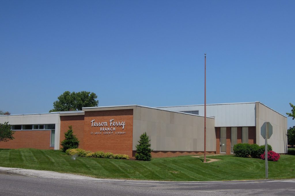
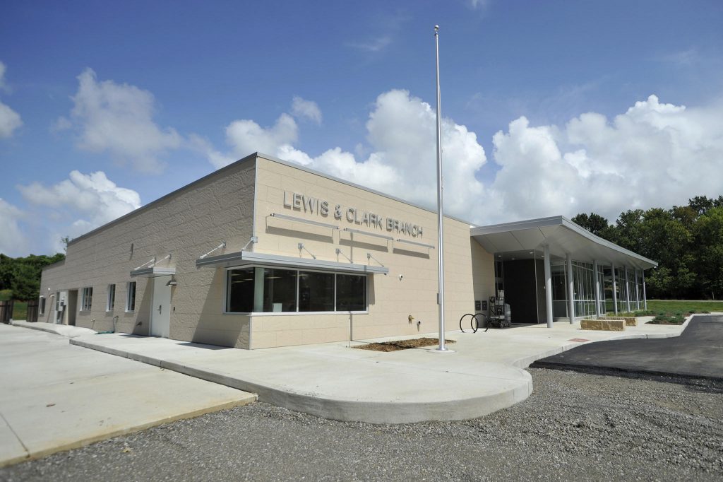
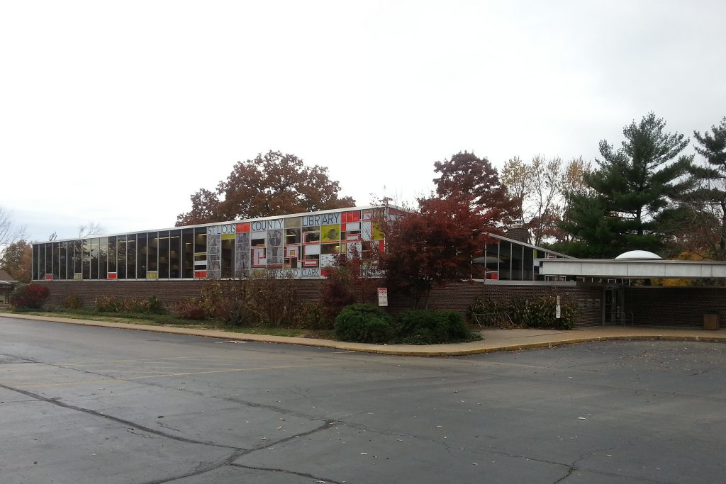
Opposition formed after plans to demolish the Mid-Century Lewis & Clark branch (1963) become more widely known in 2013. The Tesson Ferry Branch, the oldest building in the system, was also demolished. No one covered that issue better than Toby Weiss at B.E.L.T.
The current Mid-County branch building was completed in 1977 to serve as the St. Louis County Library Mid-County branch after the Clayton Public Library became part of the larger system. The 16,395 sf library would be replaced by an 18,852 sf building. The existing 53 parking spaces would be replaced by 49 spaces. A parking study by St. Louis Public Library was performed to address anticipated demand.
Plans for the new library will be presented to the Clayton Architectural Review Board at a time yet to be set. Design work for the project is by Christner, Inc.
From the St. Louis County Library 2012 Master Plan:
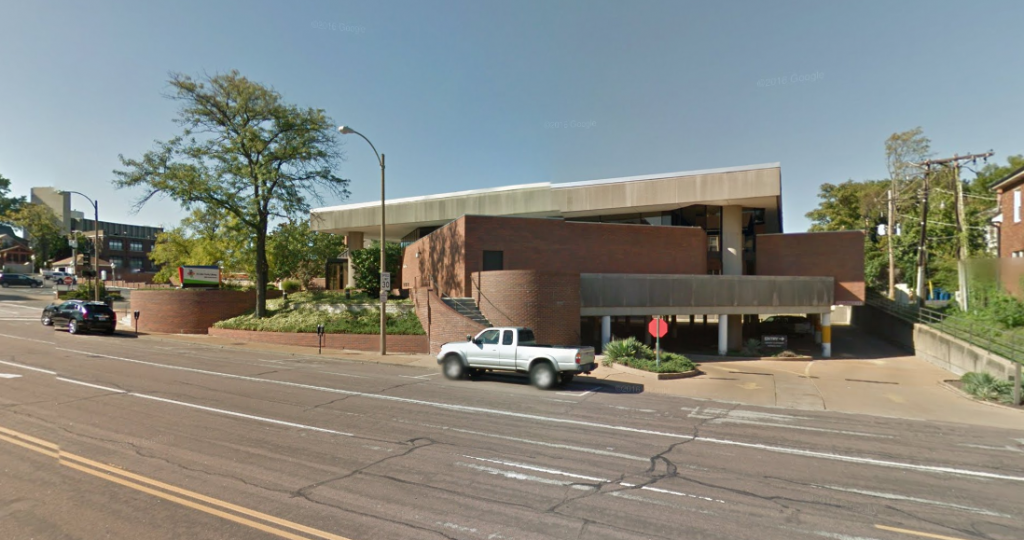
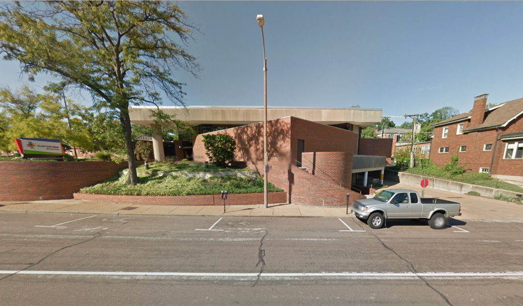
Existing Mid-County Branch:
The new Grant’s View Branch replaced the Tesson Ferry location:
The Tesson Ferry Branch library was demolished in a favor the new Grant’s View Branch:
The new Lewis & Clark Branch replaced the Frederick Dunn designed 1963 building:
The original Lewis & Clark Branch library, demolished 2014:
About Alex Ihnen
May 08
Is Subsidizing Structured Parking Worth It?
Some developers have cited the high cost of providing structured parking as part of their justification when seeking tax incentives. Perhaps we’re not subsidizing profits, rather we’re subsidizing structured parking.
 When presenting the Everly (a tax abated apartment building with 211 structured parking spaces), the Clayco representative said they’d charge residents $50 per month for a parking space, but each space actually costs $150 per month. The market wouldn’t bear the actual cost of car storage. So is the cost borne by the owner in less profit, by tenants in higher lease rates whether they have a car or not, or by the public in the form of a tax subsidy?
 According to Carl Walker, a parking consultant, the median cost of a structured parking space in St. Louis is $19,417. An underground parking spot costs more. The deeper they are the more they cost. One level down costs 15% more, two levels 45% more. For example 32 N Euclid, which received a $4.5M TIF has 104 subterranean spaces on two levels. $19,417 x ( 1.15 x 52 + 1.45 x 52) = $2.6M. On top of the construction cost one should add the operation and maintenance costs. See a Victoria Tranport Policy Institute Analysis of parking costs.
 Let’s assume a project wouldn’t happen but for the parking. Structured parking usually doesn’t add to the building’s footprint meaning more land efficiency. An equal amount of cheaper surface parking would require more land. The Citizen Park building at Lindell and Euclid, which received a 10-year 100% plus 5 at 50% tax abatement, has over 300 parking spaces on four levels, three of which are underground. The original plan had 2 levels of underground parking. Despite ample parking nearby, transit options, and walkability of the neighborhood, NIMBYs insisted upon more parking.
 Let’s imagine there was cheap virgin land next door to put surface parking. The overall project cost goes down and the developer no longer needs the tax incentive to move forward.
 {The Orion received a $10M TIF. It has 445 parking spaces. $19,417 * 445 = $8.6M}
The thing is the public is still on the hook for the infrastructure along that low-productivity surface parking. More street, streetlights, water pipe, sewer pipe, etc for taxpayers and ratepayers to maintain.
Of course surface parking next to Citizen Park would have never happened. What does happen is developments in auto-oriented places do have the option to build surface parking and do so. To make the numbers work the developer doesn’t need tax incentives. But a subsidy exists in the form of the public’s infrastructure and service obligation; it’s just not on the developer’s pro forma.
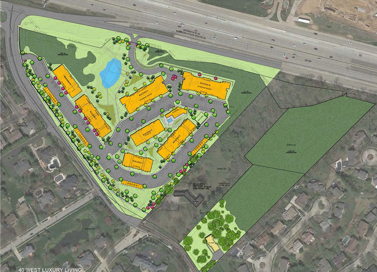 The proposed 40 West Luxury Apartments in Chesterfield contains 258 apartments over 10 acres- more than 10 times the land area of the 217-unit Citizen Park.
 We’re left to choose between the public’s perpetual obligation to provide infrastructure or the tax subsidy for the structured parking which will be the obligation of the property owner to maintain. Is the public’s obligation to build and maintain that infrastructure more costly than the tax incentives? We need to do the math!
Perhaps the lesson here is the realization of how costly the “need” for parking is, and how it is socialized. We subsidize it to get an urban form to maximize the land use’s productivity relative to the amount of infrastructure serving it or we build in an auto-oriented form and obligate ourselves to more infrastructure than a traditional form would require. And then we wonder why we can’t keep up with infrastructure maintenance and why our taxes and utility rates keep going up.
May 05
Ferris Wheel Proposed for Delmar and Skinker
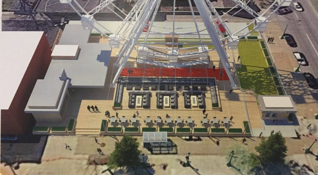 A 120-foot diameter Ferris wheel is proposed for the southeast corner of Delmar and Skinker in The Delmar Loop. Tony Sansone, Jr. and his son Michael Sansone of Sangita Capital Partners, and Todd Schneider of Pacific Development LLC kicked off the community engagement effort by presenting the plan to the Delmar Commercial Committee Thursday. They hope to add a family-friendly attraction to the walkable entertainment district.
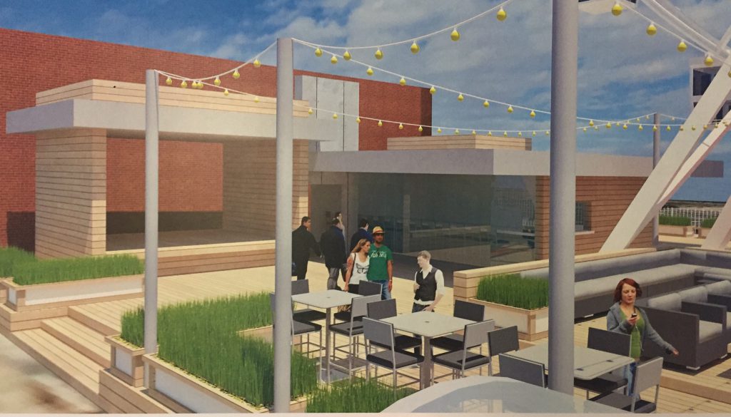 The wheel includes 20 fully-enclosed climate-controlled gondolas with capacity of six each. One ride would consist of four trips around, and your group wouldn’t be expected to ride with others. The site would include concessions including a beer garden. The operator also operates Skyview Atlanta, a larger (20 story) Ferris wheel in Centennial Park. They would sign a 10-year lease for the property and would not seek tax incentives.
Concerns about parking, distracting drivers, lighting, and height were expressed. The site plan shows 15 on-site parking spaces along the alley, and they are working on the possibility of using the New Cote Brilliant Church parking lot northwest of Skinker and Enright. They reassured the committee that lighting would not be overwhelming. Its height would be between the 8-story Moonrise Hotel and the 14-story Everly apartment building. Dwarfing the church next door is a concern for some congregation members.
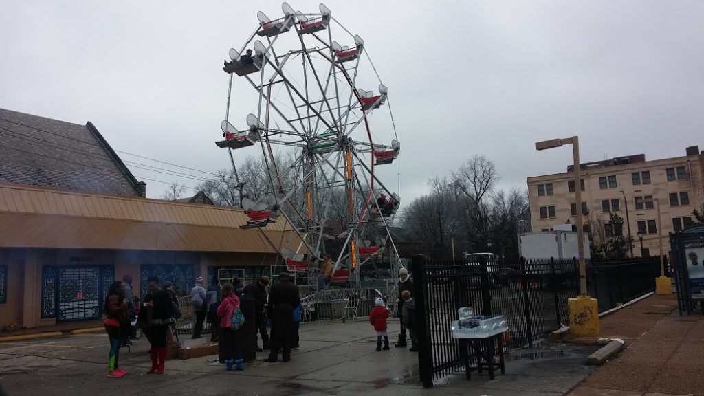 {A smaller and much less fancy mobile Ferris wheel was at the site during the Loop Ice Carnival in January.}
The parcel is currently zoned F-Neighborhood Commercial which has a height limit of three stories and 50 feet. The Ferris wheel with require a variance. It is within the SSkinker-DeBaliviere-Catlin Tract-Parkview Historic District. The Delmar Link Area Redevelopment Plan ordinance applies as well.
 {H3 Studio}
The almost 4-year vacant site (which I call both my muse and my nemesis) is shown in the Skinker DeBaliviere Neighborhood plan as a traditional building replacing the boarded-up 45-year-old fast food building. The last idea we heard about was for a paid parking lot which went no where. Michael Sansone said the owner of the property refuses to sell at a price that makes such a development feasible.
 The current condition is a poster-child of a low-productivity auto-oriented land use. It has an assessed value of $296k per acre. Across the street the single-story Pin-Up Bowl is $821k per acre. Snyder said the project cost would be about $4M. If its appraised value equals that the parcel’s productivity would top $3M in assessed value per acre. From a land productivity perspective, provided my assumption of the Assessor’s assessment is correct, it’s a big improvement.
Another consideration is the tension between adding land uses that attract more people to the Loop from outside the immediate area and those that serve residents and workers on Delmar and in adjacent neighborhoods. Or the desire for more family-friendly activities nearby. I’ve wondered what the impact of not having something like the Highlands that’s accessible to young people without a car to give them something to do. Or land uses that enhance walkability to foster car-optional living versus those that attract more cars. For example Skinker DeBaliviere lacks senior-compatible housing. This site could have a building with an elevator and would be within walking distance to necessities and transit to other parts of the city (like medical services in the CWE). Accommodating less parking would make the rents more affordable.
How many big Ferris wheels can St. Louis support? Do we wait for something better for an unknown amount of time? They are certainly other perspectives to consider. What’s yours? Let’s discuss.
May 03
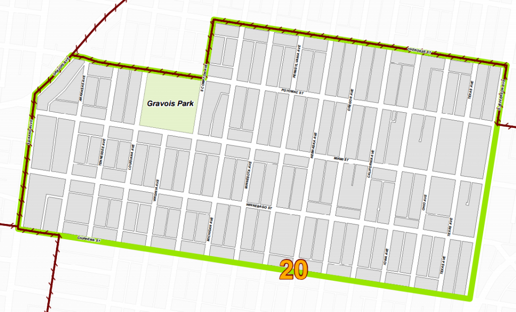
Great Things Are Happening In City’s Gravois Park Neighborhood

Great things are happening in Gravois Park. So read the sign at the corner of Potomac Street and Louisiana Avenue, planted in the northwest corner of Gravois Park.
Gravois Park, the neighborhood is just south of several “hot” city neighborhoods nearer Tower Grove Park. The neighborhood is just east of the Gravois Divide (gash, gulch, gap…?) a demarcation of race and wealth increasingly marked by Gravois Avenue. Gravois Park is just north of what are considered the stable neighborhoods adjacent to Carondelet Park.
Too often, if you read a story about Gravois Park, it likely included the word “crime”. This is changing with several significant development projects. The area has already seen increased building permit activity, and vacant homes no longer skip through the Sheriff’s auction, defaulting to city ownership as they once did. But these smaller investments often pass unnoticed and can be harder to quantify.
Large vacant buildings have a disproportionate negative impact on the perception of a neighborhood. They are obvious signs of neglect, of disinvestment. The vacant schools, warehouses, and other buildings overshadow more fine-grained successes. The reuse of large vacant buildings is generally, symbolically at the very least, the mark of more, and more varied, investment to come.
The Gravois Park neighborhood:
Cherokee Street is the northern border of Gravois Park, and the success of that commercial district is spreading. And so more investment is likely coming to the Gravois Park neighborhood after a long period of a downward trend in overall investment. Recently, Lutheran Development Group has made big investments in the area with its Chippewa Park scattered site development. LDG, also recently closed on two significant properties, both formerly owned by Holy Cross Lutheran Church.
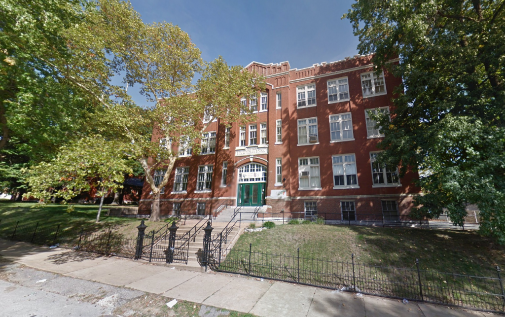
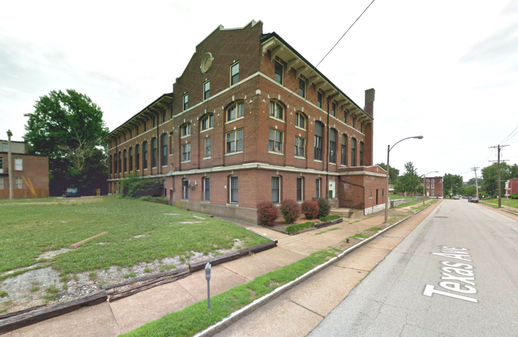
Better yet, building permits have been issued for both, a $1,059,682 permit approved for 3636 Ohio, and a $823,000 permit approved for the renovation of 3636 Texas. The school building on Ohio will be home to the 4th Eagle College Prep school in St. Louis, while the property sitting between Texas and Jefferson will be transformed into the Intersect Art Center.
3636 Ohio and 3636 Texas:
Gravois Park, the park, dates to 1812 as a Commons grant made by the U.S. government. Now the park is getting a new playground thanks to the efforts of the Cherokee Street Development League, Kaboom!, and the New Balance Foundation.
20th Ward Alderwoman Cara Spencer was recently able to redirect city demolition funds to instead stabilize a city-owned building at 3735 California. The home is near two large properties on the SW and NE corners of California and Chippewa Street that may see significant investment soon.
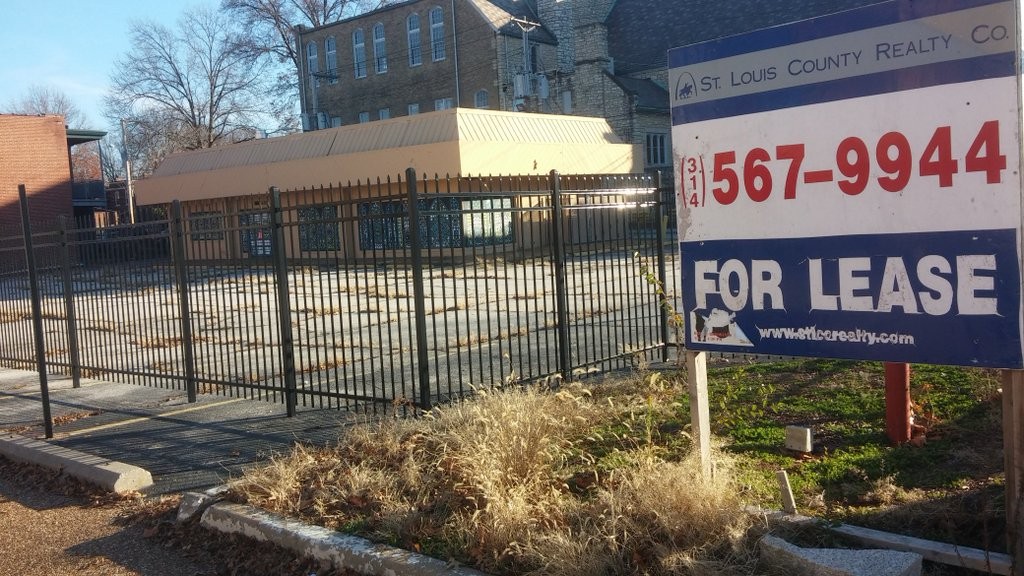
Then came news Blackline Investments LLC is planning 15 market-rate apartments for the long-vacant 3600 Texas Avenue building nearby. The city has marketed the property, offering a 10-year tax abatement since at least 1995. Blackline plans a $1.35M renovation. The project would also use state and federal historic tax credits. The Gravois Park neighborhood lies within the Gravois-Jefferson Streetcar Suburb Historic District, perhaps the largest national register historic district in the nation.
3600 Texas:
The 15 apartments would range in size from 600-1,250sf, and consist of 10 1BD and five 2BD units. Rents are planned to range from $765 to $1,195. After completion of the apartments, Blackline is reportedly interested in exploring new construction townhomes or additional apartments on adjacent vacant land.
Blackline Investments LLC is comprised of Michael Schwartz and Mark Groenda of Blackline Design + Construction. That company is known for its renovation of the Montclair on the Park apartment building on Kingshighway, Straub’s grocery, and plans for Volpi on The Hill. The company has also designed a modern apartment tower added to historic storefronts at 4528 Olive Street in the city’s Central West End. The new venture is reportedly looking for additional projects in Gravois Park.
The ongoing Gravois-Jefferson Historic Neighborhoods Plan led by Rise and Dutchtown South Community Corporation (where I currently serve as executive director), has spent the past year engaging residents and stakeholders of Gravois Park, NE Dutchtown, and Benton Park West in a proactive effort to define resident’s concerns and aspirations. The result will be a neighborhood plan supported by area alderman and codified by the city.
A wide variety of entities and individuals are also engaged in planning for a “greater” Gravois, an effort born from the misguided MoDOT plan to repave the street which has become a dividing line. Plans would have preserved six lanes of traffic, high speeds, and closed numerous neighborhood access points, reaffirming the goal of moving traffic through the area as fast as possible to the detriment of residents, retail, and quality of life of those being passed by.
Anyone who seems to have an opinion of Gravois Park talks about change. The neighborhood saw extreme white flight in the 1990s. The neighborhood was very white in 1990. The 1990 Census recorded the population as 81% white and 13% black. The 2000 count was 31% white and 60% black. 2010: 22% white, 68% black. The change has been more than the faces of residents. Poverty has increased significantly, as has building vacancy.

Despite relatively high vacancy (858 housing units per the 2010 Census), the .44 square-mile area has a population density of 12,000 per square-mile. With no real retail or industrial space, and one smaller park, the almost entirely residential neighborhood, is likely the most densely populated in the city.
From 2000 to 2010, Gravois Park decreased in population by 601 residents, from 5,826 to 5,225. This represented a 10.32% decline. That’s a lot, but quite far from the top of the list of city neighborhoods. That decade, the city saw an overall population decrease of 8%, with more than a dozen of the 79 neighborhoods recording a decrease of greater than 20%. The loss in Gravois Park was near average for the city’s 31 south side neighborhoods, which collectively saw a 9.18% population decrease.
And so Gravois Park continues to face the myriad of social and physical challenges too often present in the city’s neighborhoods. Ultimately, the lack of investment precludes be able to address community concerns. The challenge for this neighborhood may now be to shape coming investment to build a better neighborhood for all.
Apr 28
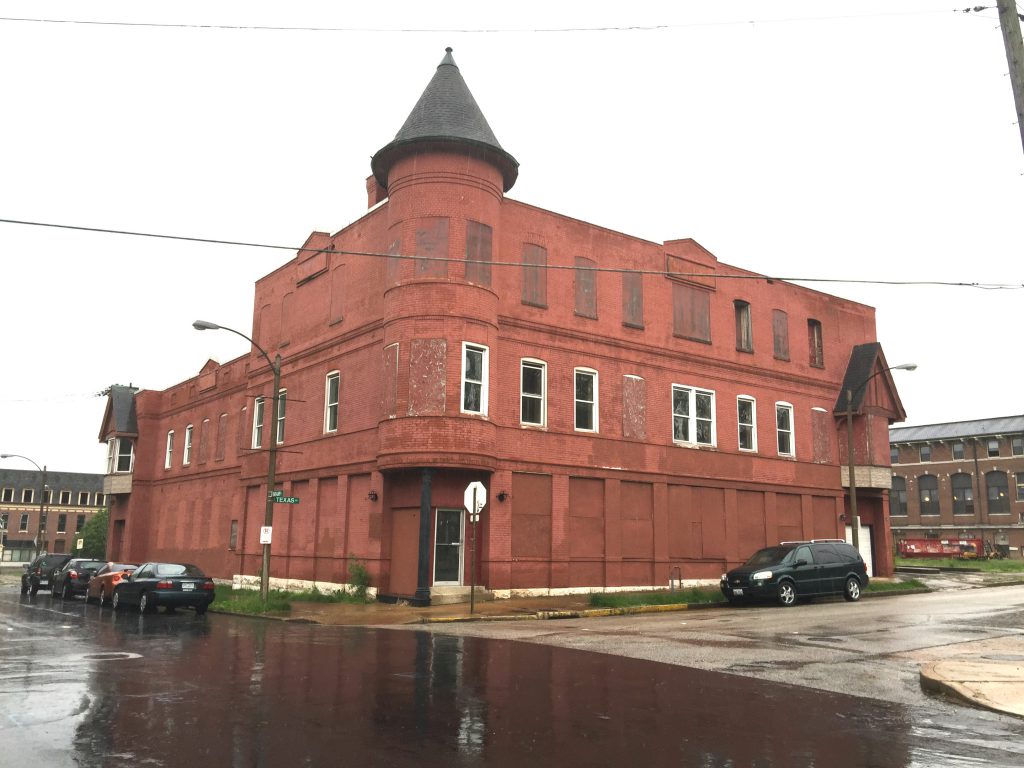
UIC Puts Hyde Park Parcels Under Contract, Proposes 350-Acre Chapter 99
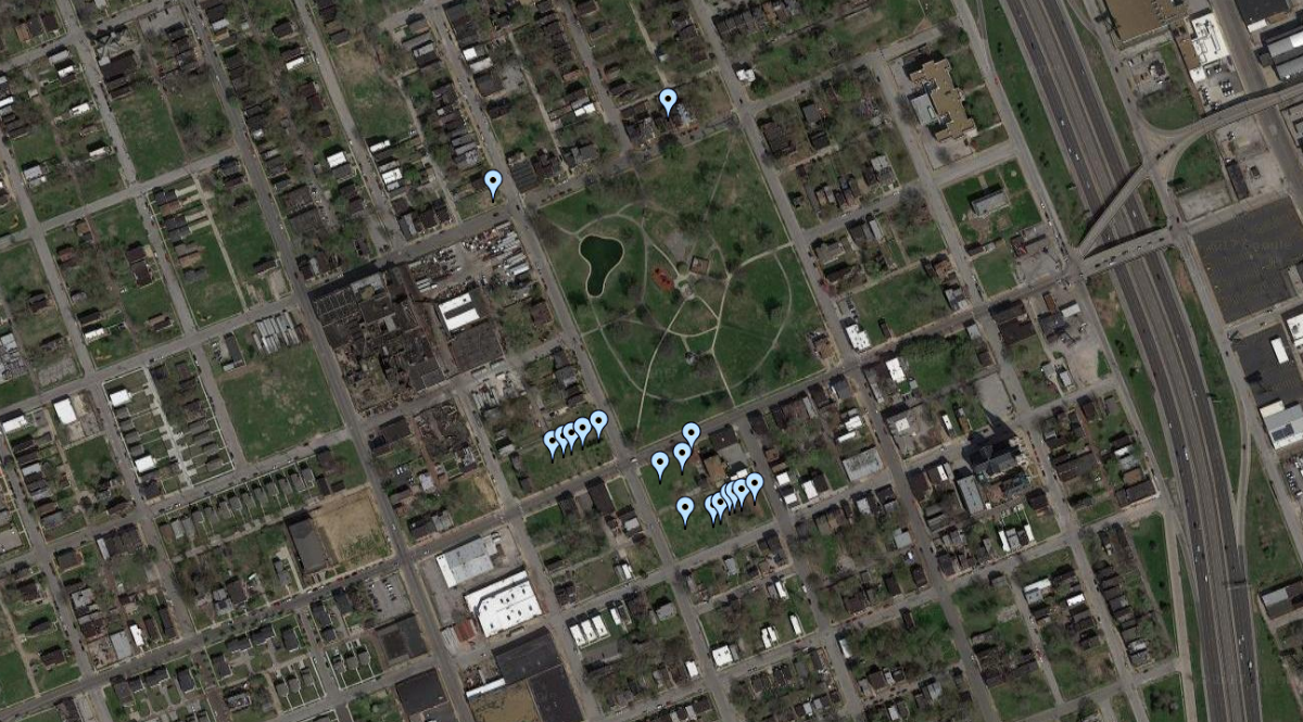
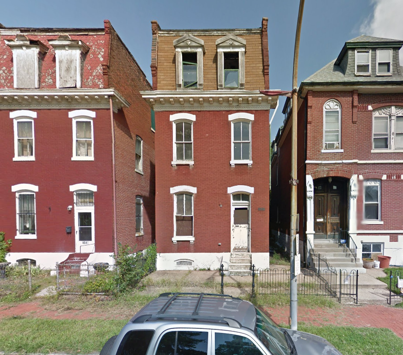
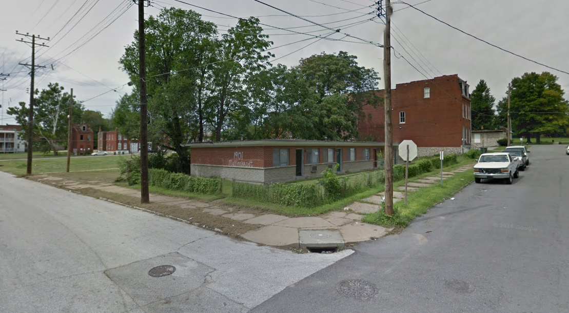
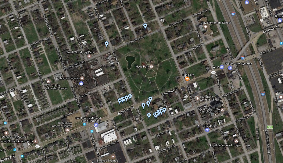
Developer UIC has 19 parcels in the city’s Hyde Park neighborhood under contract from the Land Reutilization Authority for future development. The parcels are concentrated on Salisbury and Mallinckrodt Streets near the neighborhood’s park.
UIC has found success in the redevelopment of McRee Town, an area sandwiched between rail yards and Interstate 44 in central St. Louis City. While the eastern half, eight city blocks, of McRee Town was demolished for new housing, UIC has selectively rehabbed and built infill on the eight blocks nearest Tower Grove Avenue. [Read more NEXT STL coverage of UIC]
The Hyde Park neighborhood as seen waves of redevelopment ideas and creative interventions come and go. In 2010, artist Theater Gates founded the Rebuild Foundation, which saw a partnership with Most Holy Trinity Catholic Church and Pulitzer Arts. You can read more about that effort at Art21 magazine and Art Place America.
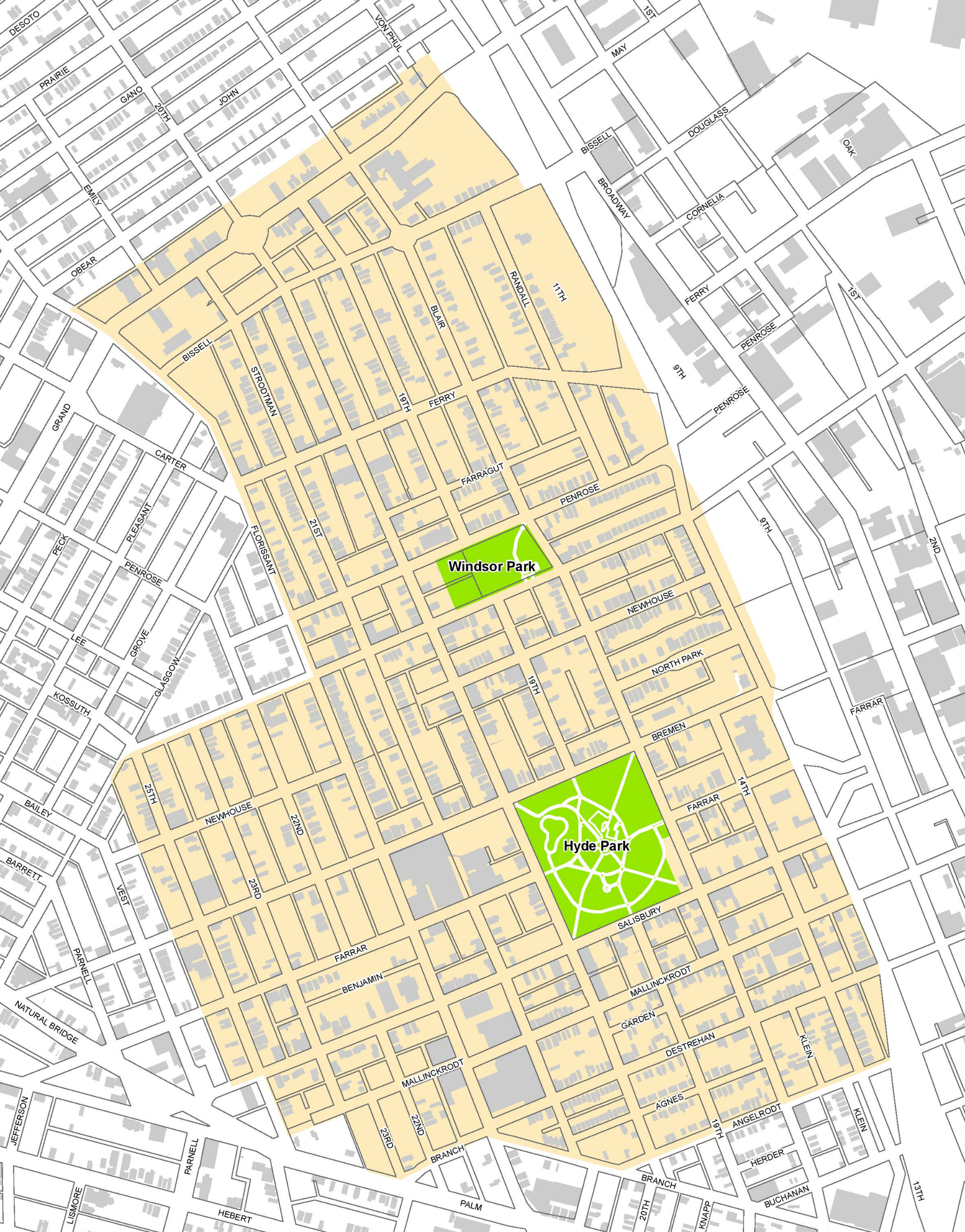
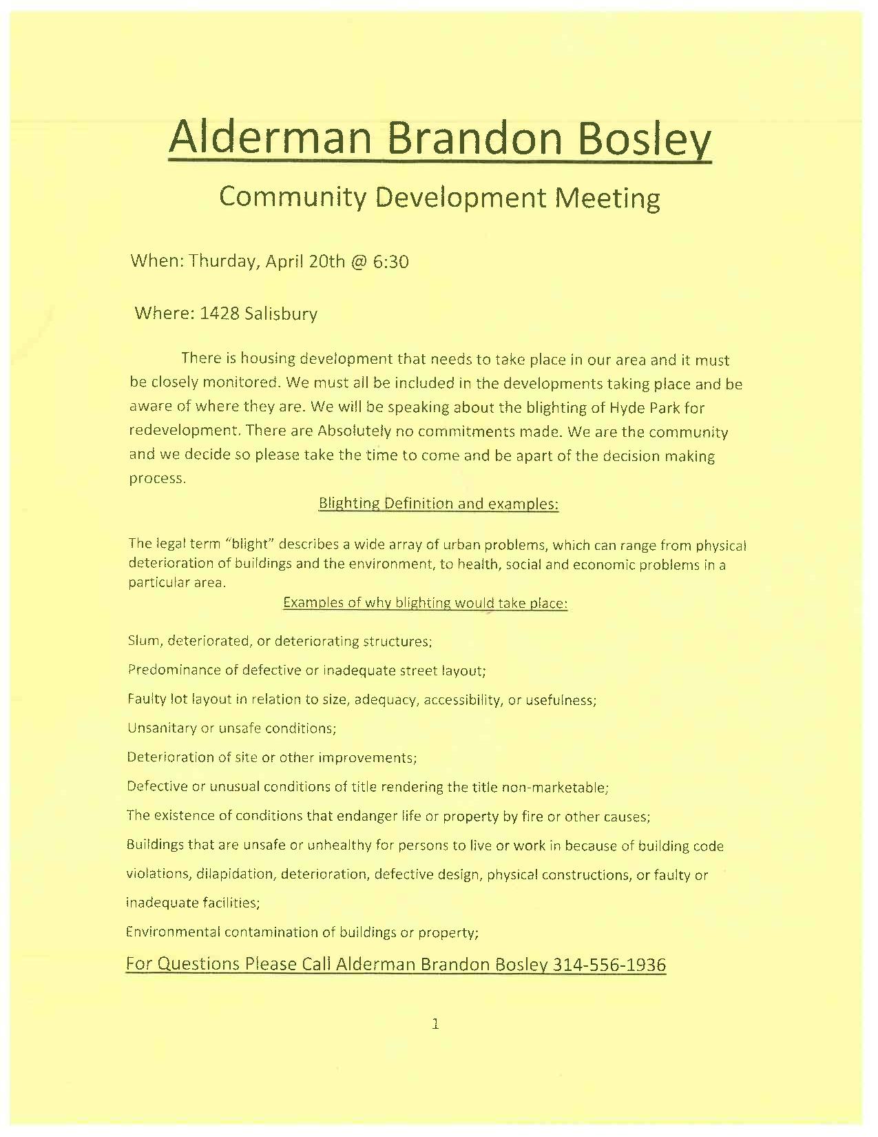
Despite academic interest and creative energy, much of Hyde Park remains abandoned and crumbling. The neighborhood lost 29% of its population (3,741 to 2,668) from 2000 to 2010. What UIC is proposing, according to information presented at a recent public meeting hosted by Alderman Brandon Bosley, is a Chapter 99 development agreement with the city’s Land Clearance for Reutilization Authority (LCRA) as developer. Eminent domain would be prohibited, as would Tax Increment Financing (TIF).
The Chapter 99 designation could cover as much as 350 acres, closely mirroring the Hyde Park Local Historic District. UIC has stated that it would actively work to help educated developers on how to take advantage of tax abatement and other incentives to develop in the area.
Chapter 99 does not designate a single controlling development entity in the same way as does a Chapter 353 designation. For example, a Chapter 353 redevelopment area was recently established surrounding the Saint Louis University medical school. A development corporation created by the university has been granted a wide array of development rights for the area. Chapter 99 would allow various developers to access incentives and complete projects with 10-year tax abatement. (Missouri Revised Statutes – Chapter 99, Municipal Housing)
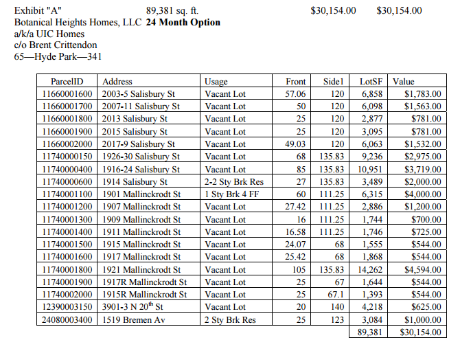
According to LRA documents, the parcels UIC has under contract total nearly 90,000 square feet and are under contract for $30,154. UIC holds a 24-month option on the properties. Sixteen of the parcels are vacant lots planned for new construction. The remaining three at 1519 Bremen, 1914 Salisbury, and 1901 Mallinckrodt have structures:
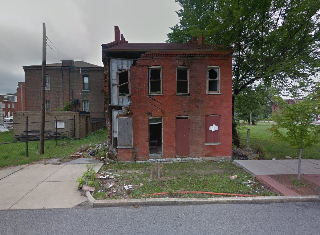
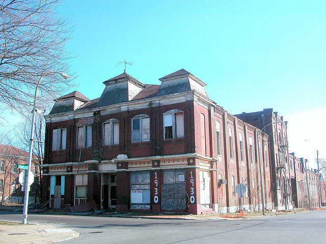
The largest parcels, along 20th Street between Mallinckrodt and Salisbury were the site of the Nord St. Louis Turnverein, a landmark of the area’s German heritage dating to 1879. From architectural historian Michael Allen: “Hyde Park began as the German-founded town of Bremen in 1844, and for the first 100 years of this area’s development, Germans were involved in every aspect of civic life here. Despite annexation by the city of St. Louis in 1855 and an influx of immigrants of other nationalities, Hyde Park retained a distinctly German character.”
Allen covered the neglect of the Turnverein in 2005, its destruction by fire in 2006, and its demolition in 2011. The Nord St. Louis Turnverein in 2006:
Apr 28
Westin Hotel, Retail Planned for Habitat for Humanity Site on FP Avenue
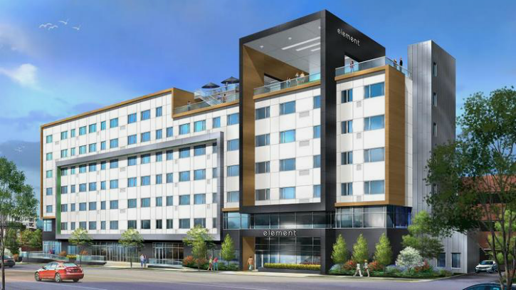
Today, we’ve learned what may be next for the Habitat for Humanity site listed for sale this past August. There were reportedly multiple bidders for the property across from the massive City Foundry project, and near Cortex. Plans show a 7-floor, Element Hotel by Westin fronting Forest Park Avenue.
Planned for the former Headquarters of Habitat Humanity, The Hotel will add to the ever changing Forest Park Parkway-Vandeventer area of Midtown. The $25 Million project will bring around 150 Rooms to the area and add to the Urban Streetscape of Forest Park Avenue. Upon Completion in 2018, if goes as planned, it will be another key part of this region’s revitalization. The Element Building will have 10,000 square feet of street-level retail space facing Forest Park Avenue, adding to what is set to become the first major retail district in St. Louis City in decades.
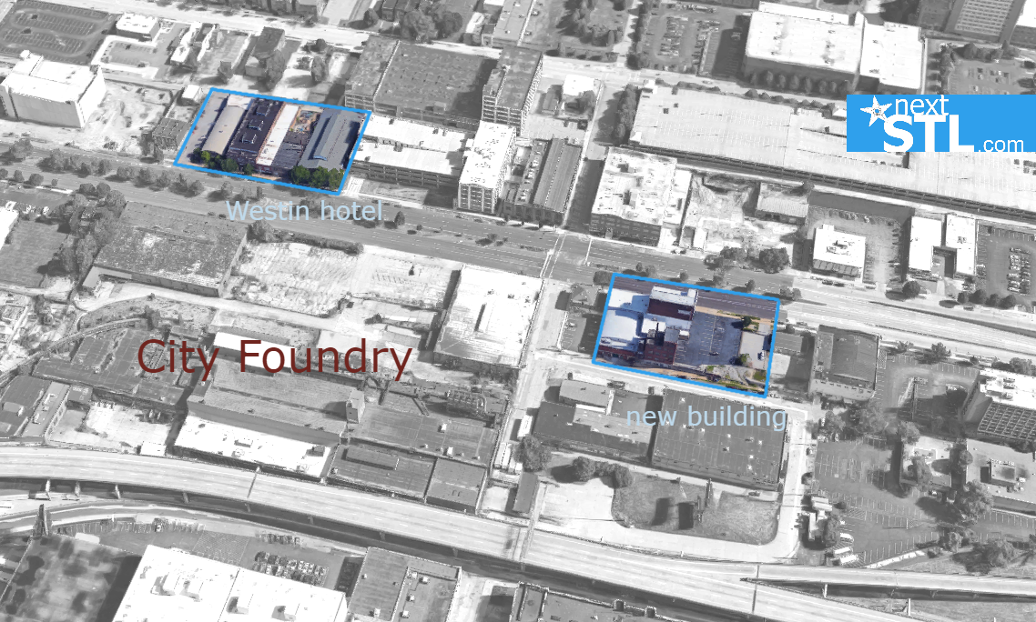
An aerial image of the hotel showing context with City Foundry also appears to show previously unknown buildings at that project. The new tower, east of the BYCO building, which is rumored to be a grocery store, appears to be on the site of the Falstaff Brewery Plant No. 1. The building has been home to Jimmy John’s, The Lab Gym, and other uses in recent years.
*This story will be updated.
About Chris Stritzel
Apr 28
Friday Live Chat – nextSTL
Apr 26
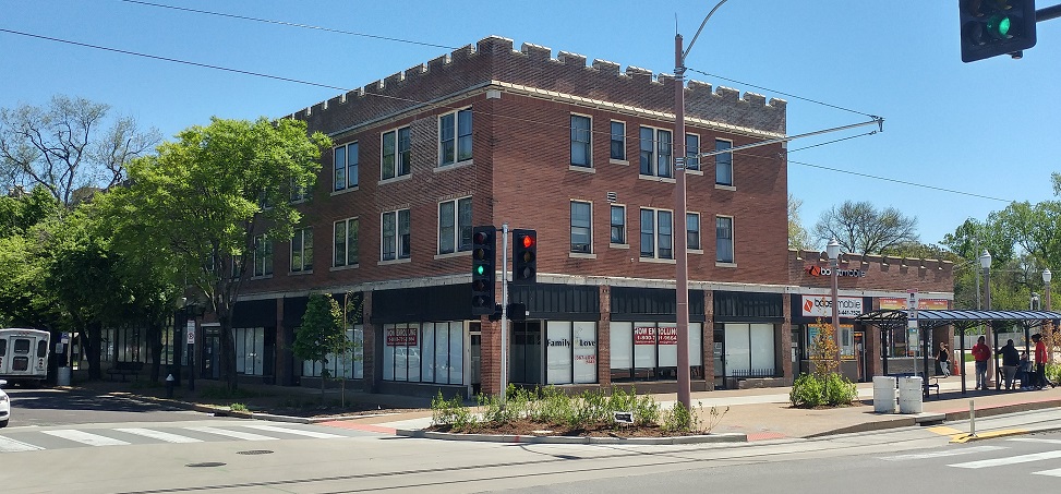
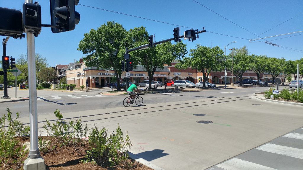
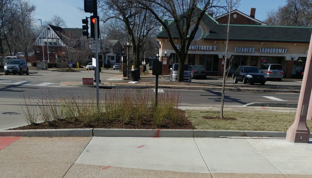
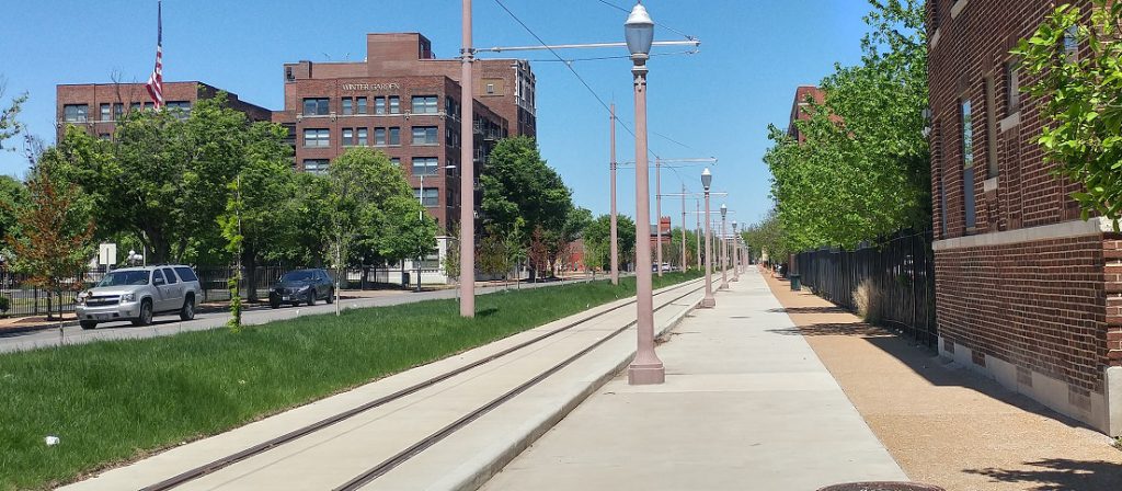
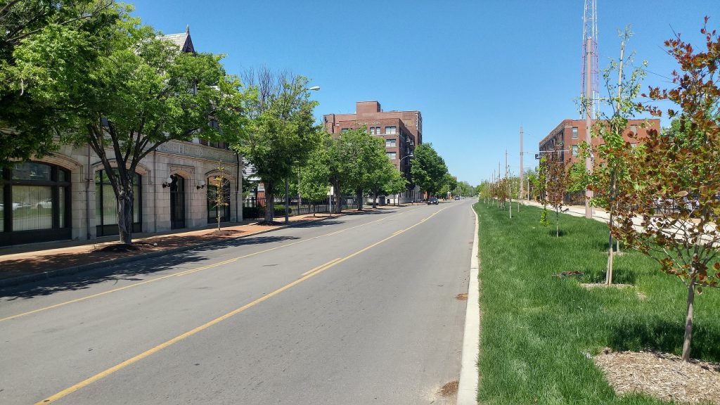
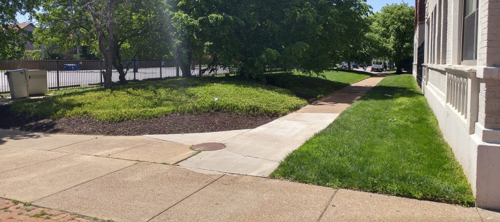
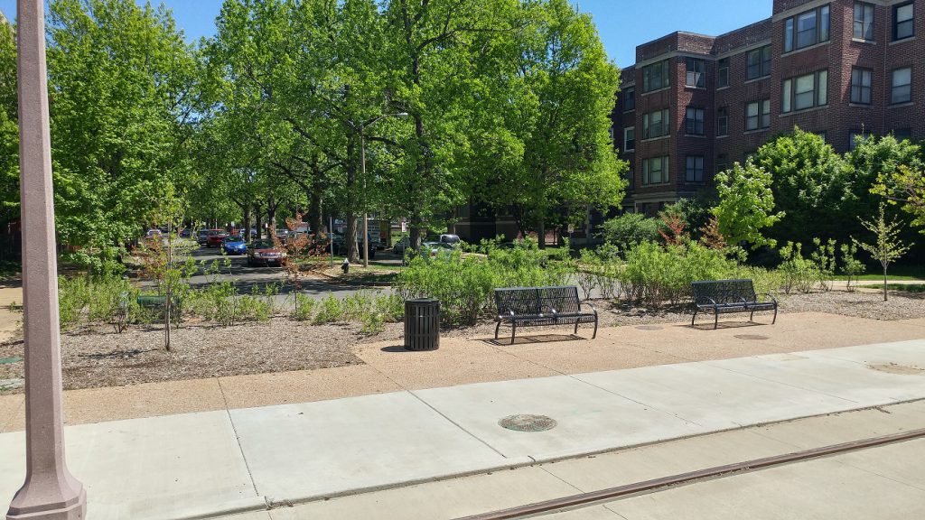
Loop Trolley Corridor Photo Tour: DeBaliviere
As the Loop Trolley project nears completion let’s look at the changes to the streetscape and the condition and potential of the adjacent land. A goal of the trolley is to encourage development along the route. Neighborhood and TOD plans for the area express a desire to build urbanity. Beyond creating a great walkable neighborhood, more productive land uses are imperative to cover the cost of infrastructure and services in the long term. Public investment should follow private investments so as to minimize the public’s risk. Parts of the trolley route are quite productive, so the route may have a good combination of supporting productive places and “built ti and they will come.”
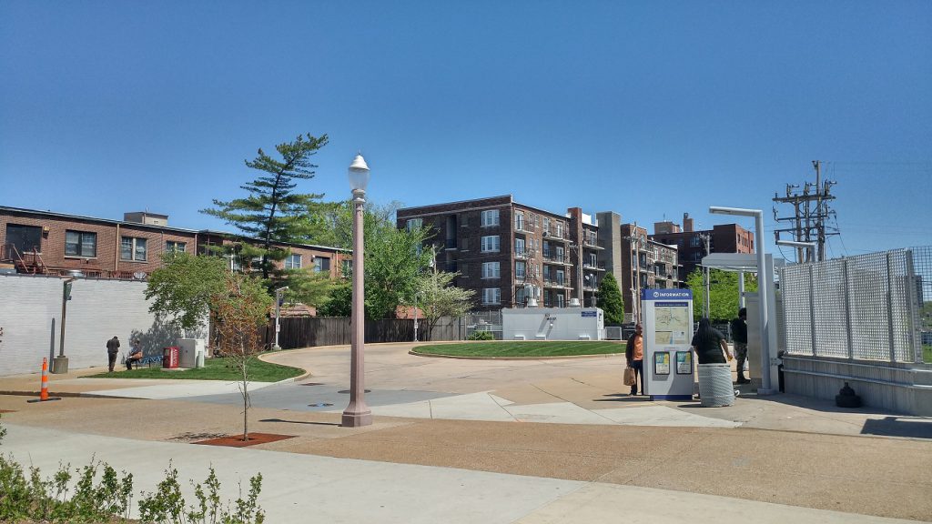
The trolley operates on a single track from the Missouri History Museum up DeBaliviere alongside the St. Vincent Greenway then heads west at Delmar.
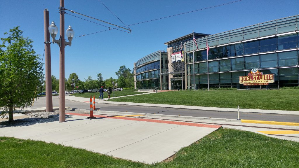 The Missouri History Museum stop. The trolley won’t go this far when the museum is closed. Perhaps a shelter could be an incremental improvement later.
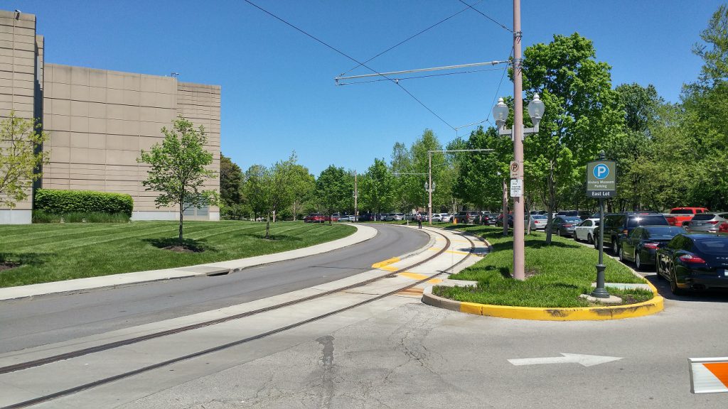 Heading north along DeBaliviere.
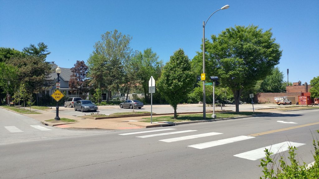
 At Lindell Blvd. Pedestrian infrastructure has improved, though there are drainage problems on the northeast corner. I would love pedestrian refuges in Lindell. Because DeBaliviere is divided here, there is room since there are no turn lanes in the crosswalks. They would help slow cars and aid crossing Lindel.
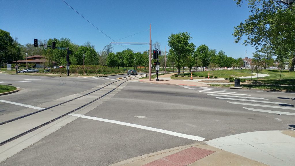
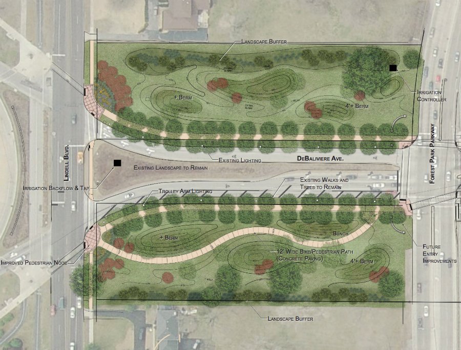 The land along DeBaliviere between Lindell and Forest Park Parkway is a part of Forest Park. Inactive grass for many years, it is now getting a landscaping overhaul.
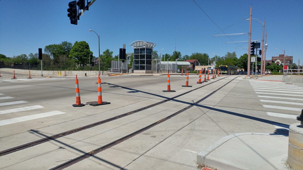
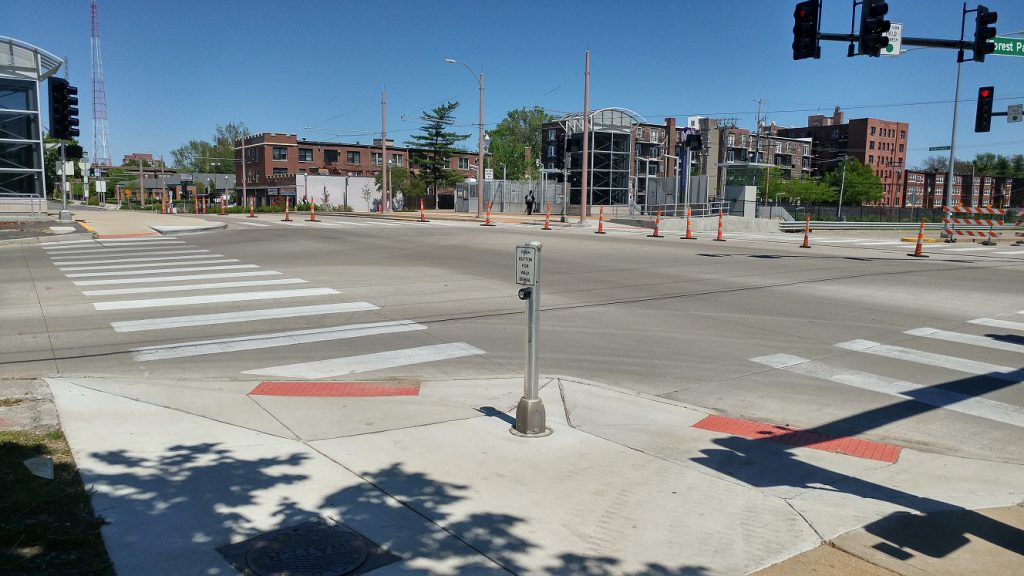 At Forest Park Parkway. The intersection was completely rebuilt. Pedestrian infrastructure has greatly improved.
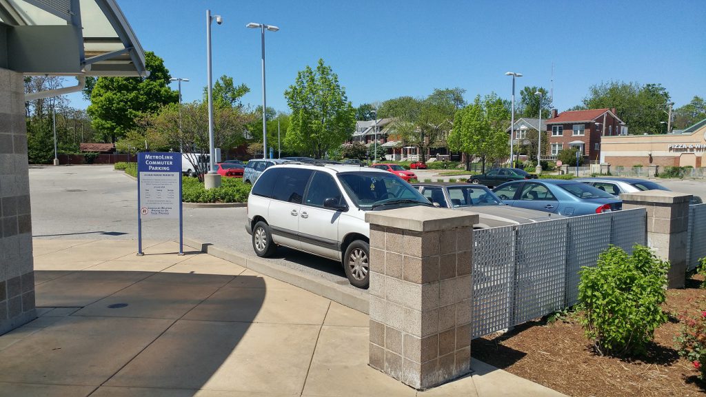 There’s a development opportunity at the 1.5 acre Metrolink parking lot. Bi-State provides 118 government-subsidized parking spaces. The tax exempt land use generates no revenue for the SLPS, the city, ZMD, MSD, etc. Let’s hope it joins the tax rolls sometime soon.
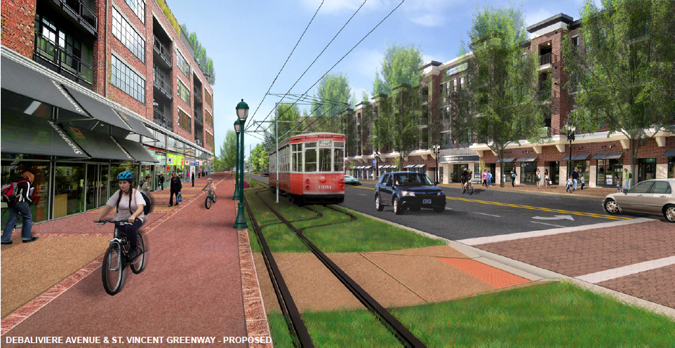
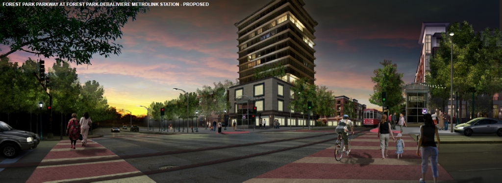 Vision for Forest Park Parkway and DeBaliviere. H3 Studio
 Another development opportunity across the street on another tax-exempt Bi-State-owned lot. It kept its curb cut.
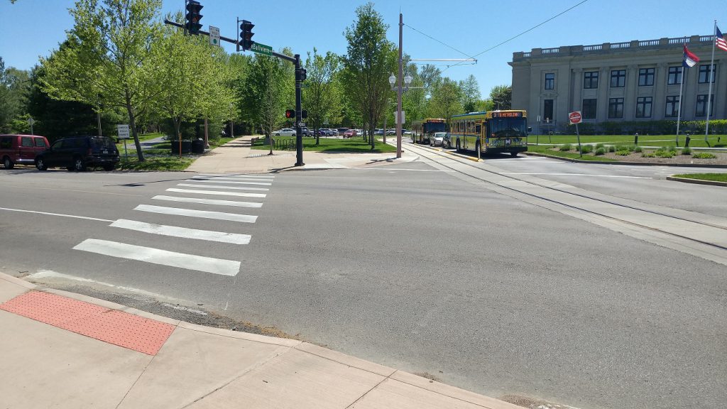
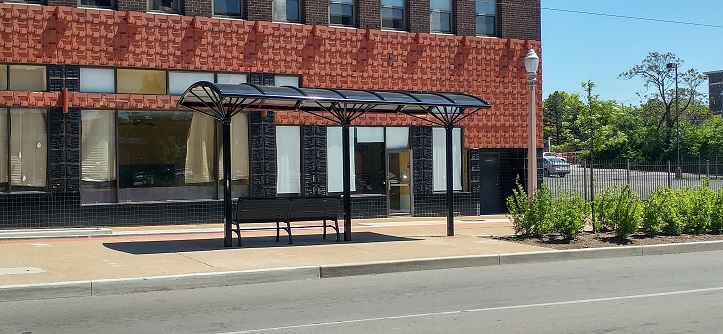
 Trolley stop at Pershing. It is shared with the 90 Hampton and 3 Forest Park Trolley buses. Annoying that it’s not closer to the Metrolink station.
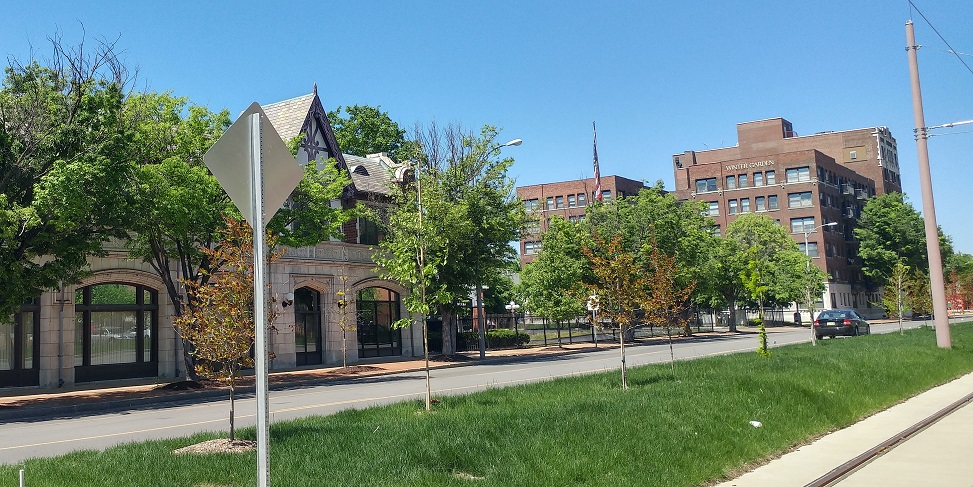
 The traditional building at DeBaliviere and Pershing has an assessed value per acre of $833k.
 The intersection of DeBaliviere and Pershing. Three sides of the intersection are greatly improved.
 A crosswalk on the north side is missing. I complained about this to the Trolley Company last year when it became apparent it was missing. The engineer said that the reason it wasn’t put in was that the vast majority of the foot traffic is north-south (a non-sequitur IMO), and that it was too difficult to put an ADA compliant crosswalk there. I suspect no one seeking to cross there will go 3/4 around the intersection as we see at the missing crosswalk at Euclid and Forest Park Avenue. Ignoring reality is regrettable.
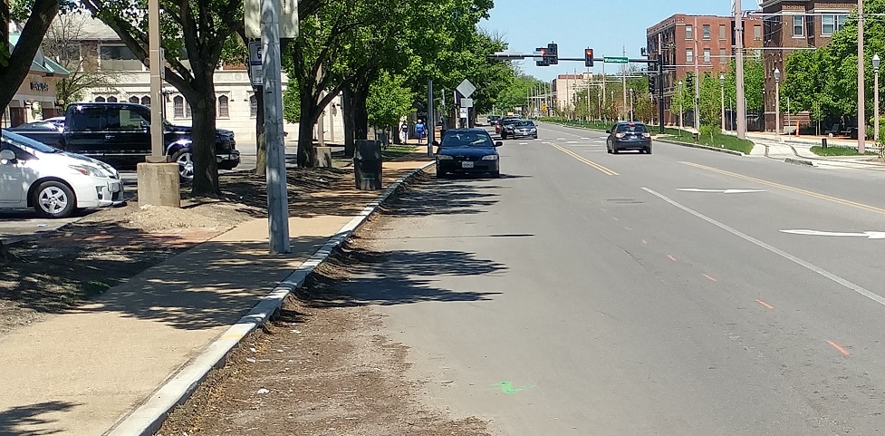
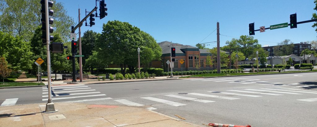
 Redevelopment opportunity on DeBaliviere between Pershing and Waterman. Unfortunately the traditional buildings here were demolished in the 1980s for this low-productivity auto-oriented land use. It’s assessed value per acre is $249K. I suspect it’s not covering its burden on city services.

 Vision for the strip mall redevelopment looking southwest from Waterman and DeBaliviere. H3 Studio
 Street Parking was added on the west side of DeBaliviere.
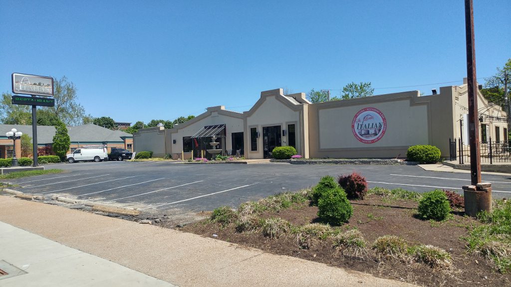 Redevelopment opportunity across the street. This low-productivity auto-oriented land use has an assessed value per acre of $239k.
 It and the property next door get to keep their curb cuts. Quite an amenity for such low return.
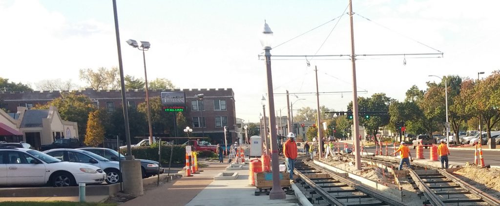 They could have shared one or used alley access as they did when construction blocked access from DeBaliviere- somehow auto-dependent patrons found their way.
 The intersection of Waterman and DeBaliviere looking southeast.
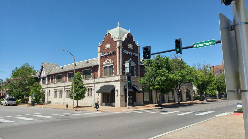 The intersection of Waterman and DeBaliviere looking northwest.
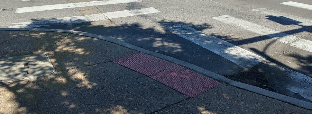 The curb cut at the southwest corner is awkward for north-south travelers.
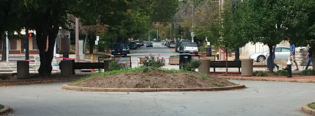 {#Healthegrid}
This was a missed opportunity to heal the grid, relieving traffic pressure on Pershing and providing quicker access for EMS.
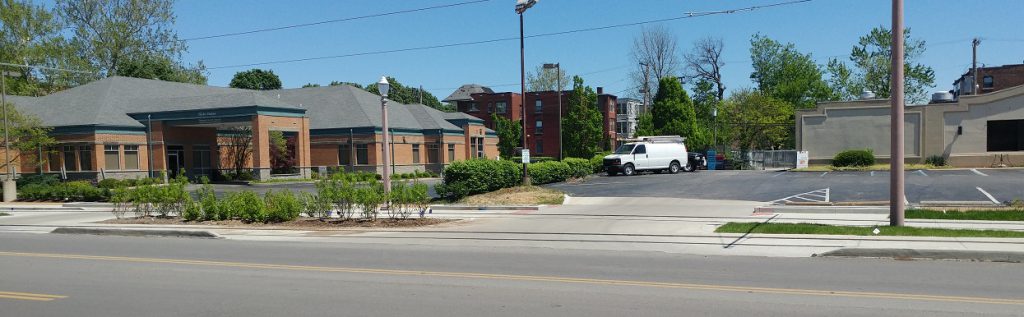
 Development opportunity on the absurdly large Busey Bank parking lot. Unfortunately the traditional building at 433 DeBaliviere succumbed to fire in 1970.
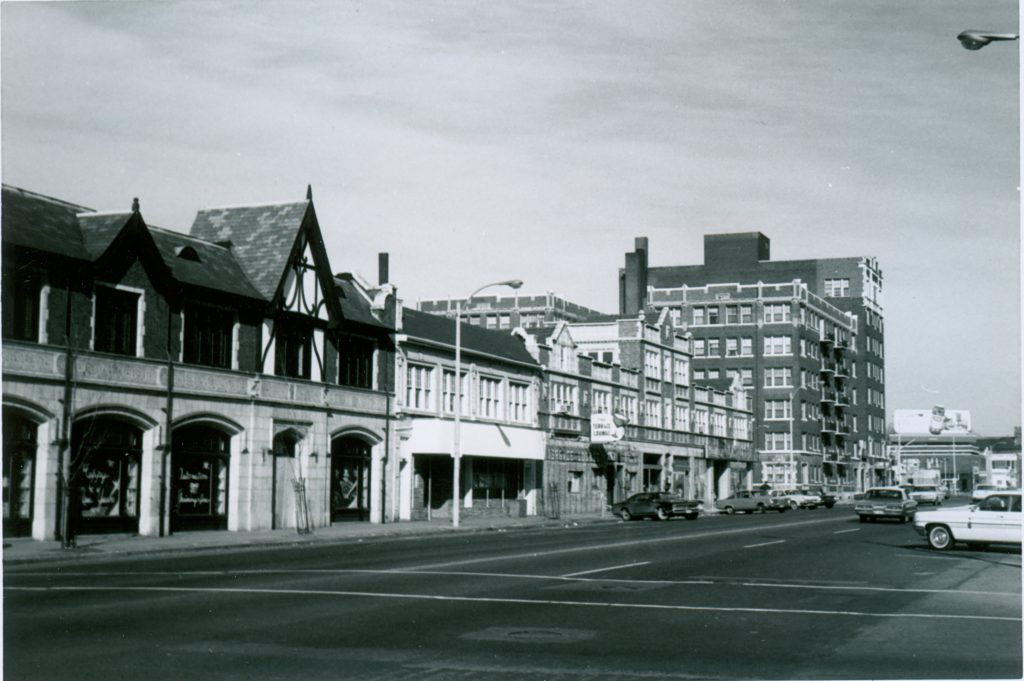 400 block of DeBaliviere. What was best exemplifies what should be.
 Some parts of the east side of DeBaliviere have a highway feel due to lack of street parking, wide lanes, low-rise land uses, and the grassy strip running next to it. The trees may help as they grow.
 McPherson blocked at DeBaliviere
 Kingsbury blocked at DeBaliviere
 Development opportunity across from Crossroads School. The school owns the parcel, and it is tax-exempt. Hopefully it will join the tax rolls soon.
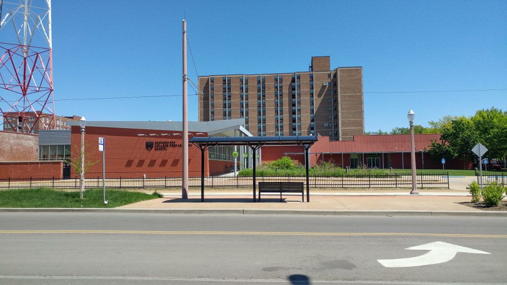 Crossroads School got to keep both its curb cuts and has a trolley stop, tax-exempt.
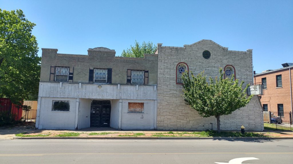 Left – This sad-sack building, owned by someone in Frontenac living in a $1,345,000 home, could use some love. Right – A small church, tax-exempt.
![]() KMJM 100.3 transmission tower. Any chance it could move?
KMJM 100.3 transmission tower. Any chance it could move?
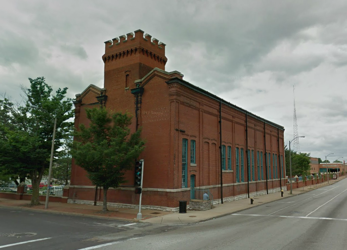
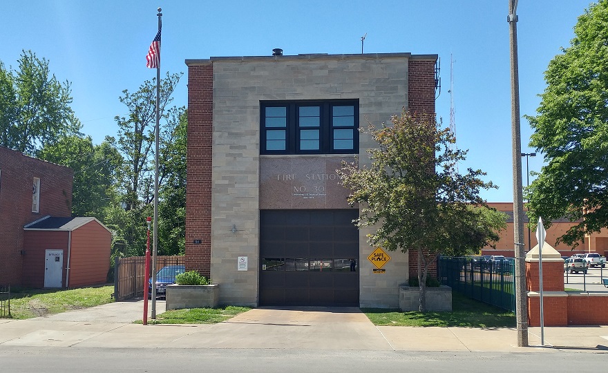 Cute fire station No. 30, city-owned and tax-exempt of course.
 Tax-exempt car storage with three-lane curb cut for Crossroads School.
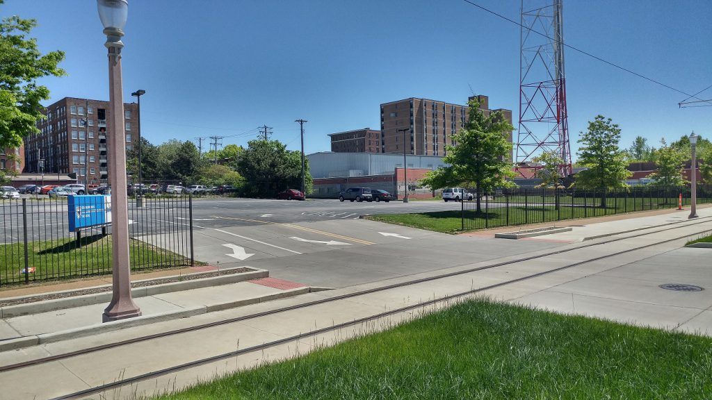
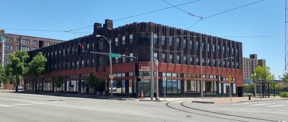
 The behemoth Metro garage- tax-exempt.
 {H3 Studio}
The Skinker DeBaliviere neighborhood plan shows the possibility of the garage being vacated and available to be developed.
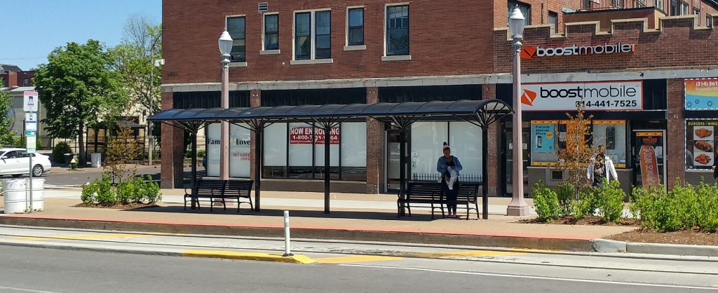
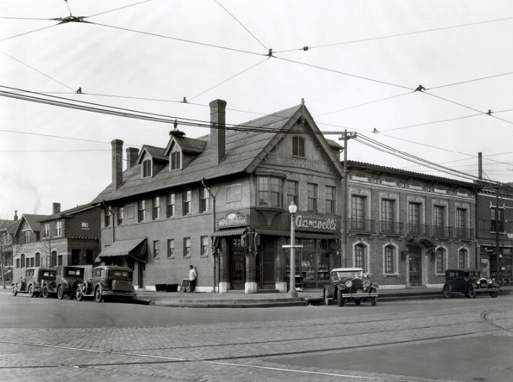
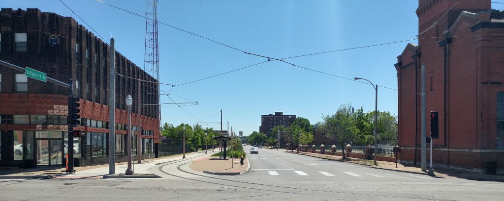
 DeBaliviere at Delmar is adorned with two really cool buildings and has a trolley stop.
 566 DeBaliviere. Numerous pictures at St. Louis Patina.
 Across the street. My dream for this is a micro-brewery. There’s space for the outdoor biergarten already.
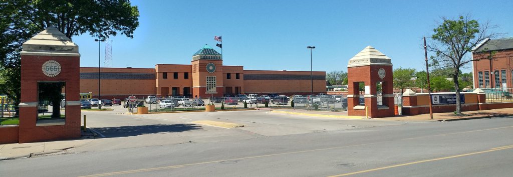
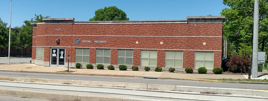 Social Security office- tax-exempt.
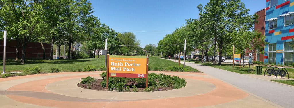 Ruth Porter Park with the St. Vincent Greenway extends north. I wonder if it would have been better to extend DeBaliviere north.
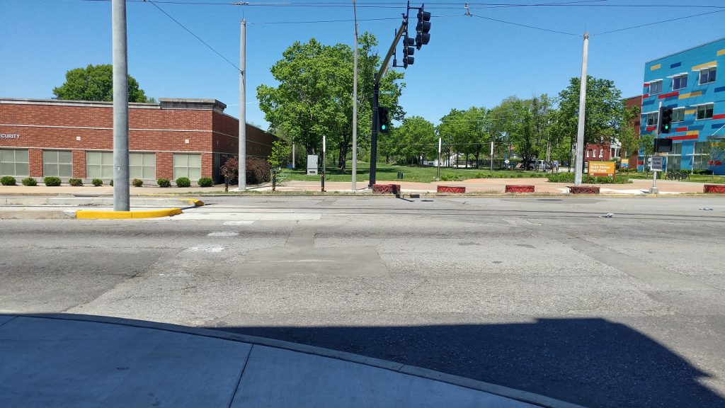 Another crosswalk is missing on the west side of DeBaliviere at Delmar.
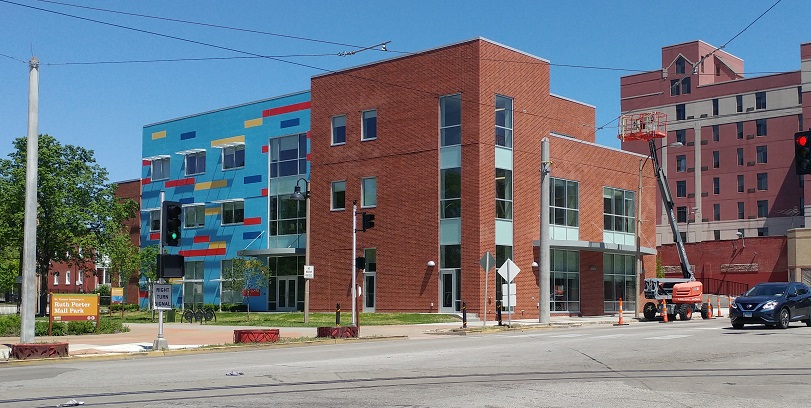 The new Adolescent Behavioral Health Center by People’s Health.
 The remake of DeBaliviere with the Loop Trolley and St. Vincent Greenway has greatly improved it. Four driving lanes were too many, and the street diet is welcome. Regrettably only one of the eight private curb cuts crossing the trolley’s path has been removed- a nod to the continued auto-orientation of the corridor. Three public street blockages were maintained. On-street parking has been added on parts of the west side of DeBaliviere. Some parts of DeBaliviere and the greenway have a highway feel.
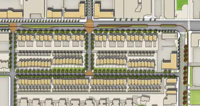
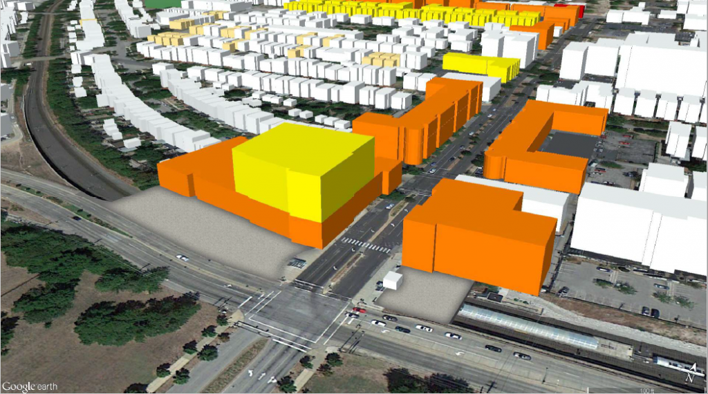 {Massing of DeBaliviere from TOD plan. H3 Studio}
With so much tax-exempt and low-productivity land uses along DeBaliviere, this part of the route isn’t pulling its weight. Let’s hope more productive land uses will come soon.
Apr 25
City’s Preservation Board Greenlights Smart Infill, Deny’s Needless Demo
Yesterday, the City of St. Louis Preservation Board had a good day. The decisions of that board, informed by recommendations from the city’s Cultural Resources Office, are generally quite straightforward, mostly unexciting. There are a lot of denials of generic Home Depot doors in Local Historic Districts, and things of that sort.
The board’s role is constrained. It can’t require better urbanism, but absent a city-wide housing and development policy, the Preservation Board takes on part of the city-building role. The board takes public testimony, is presented plans by developers, and adjudicates the future of a building or development, and in this way, our city.
So what did the Preservation Board do yesterday? It gave preliminary approval to the big infill project at the long-vacant Praxair site in Lafayette Square. A first hearing was greeting largely by people in opposition. This time, neighborhood residents in favor of the plan spoke up.
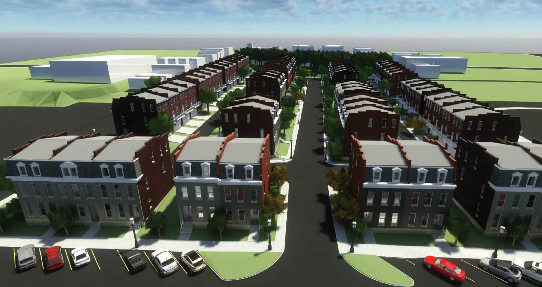
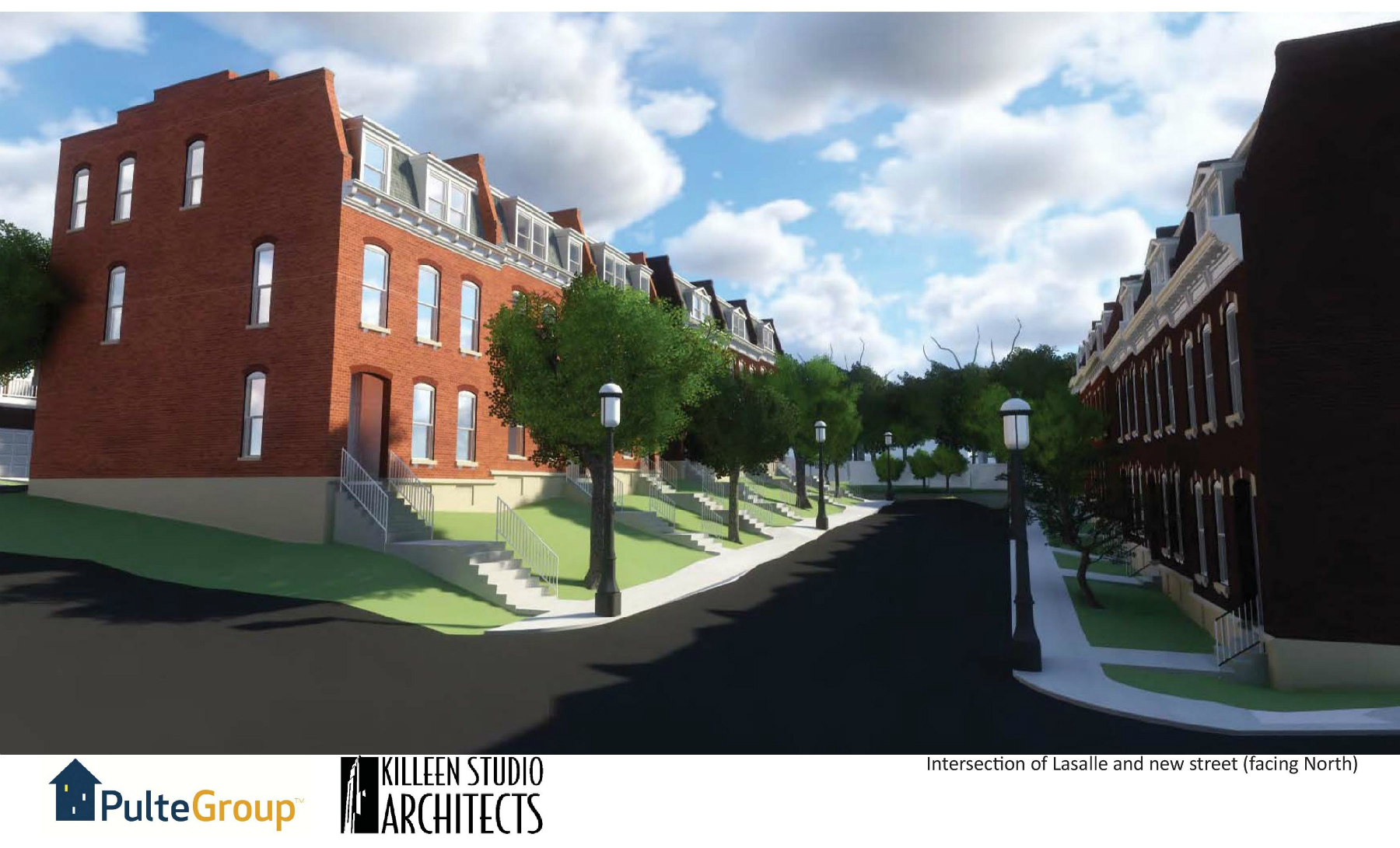
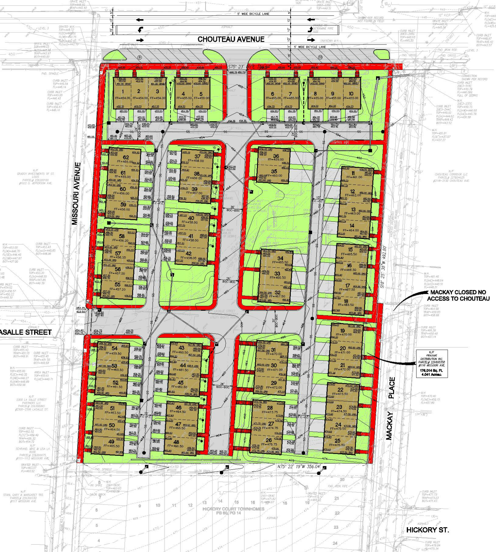
The approval comes with some caveats, that the townhomes be fully wrapped in a brick veneer, that sidewalks be added to LaSalle Street as it extends into the development, and that units facing Chouteau Avenue be re-presented with design changes. Such caveats are quite common in board decisions.
The townhomes by Pulte Homes and Killeen Studio Architects aren’t perfect. Better design is hampered by the Local Historic District, for better or worse. For an industrial site on the edge of the Lafayette Square neighborhood, more should have been allowed by code. The focus should have been better urbanism and less an aesthetic pursuit. Such is the changing nature of urban historic preservation.
Assuming the project moves forward, it represents what more-fancy urban planners call “gentle density” or “density done well”. In St. Louis too many people think of it as scary density. That vacant industrial lot that exploded a decade ago? It didn’t create any traffic, no noise…you get the idea.But townhome development is very significantly more sustainable, produces a much greater return to the city, than single-family homes.
But townhome development is very significantly more sustainable, produces a much greater return to the city, than single-family homes, even the big historic ones in Lafayette Square. It’s a balancing act to be sure, but when and where townhomes can be developed in a thoughtful, urban manner, the city (and residents) should offer support.
Read more: Changes Present Better Urban Design for Lafayette Square Praxair Site
____________________________
What else did the board do? It denied a request by the Missouri Foundation for Health. Its mission reads, “to improve the health and well-being of individuals and communities most in need.” It hired architectural behemoth HOK to repurposed the Columbia Iron Works site in Forest Park Southeast.
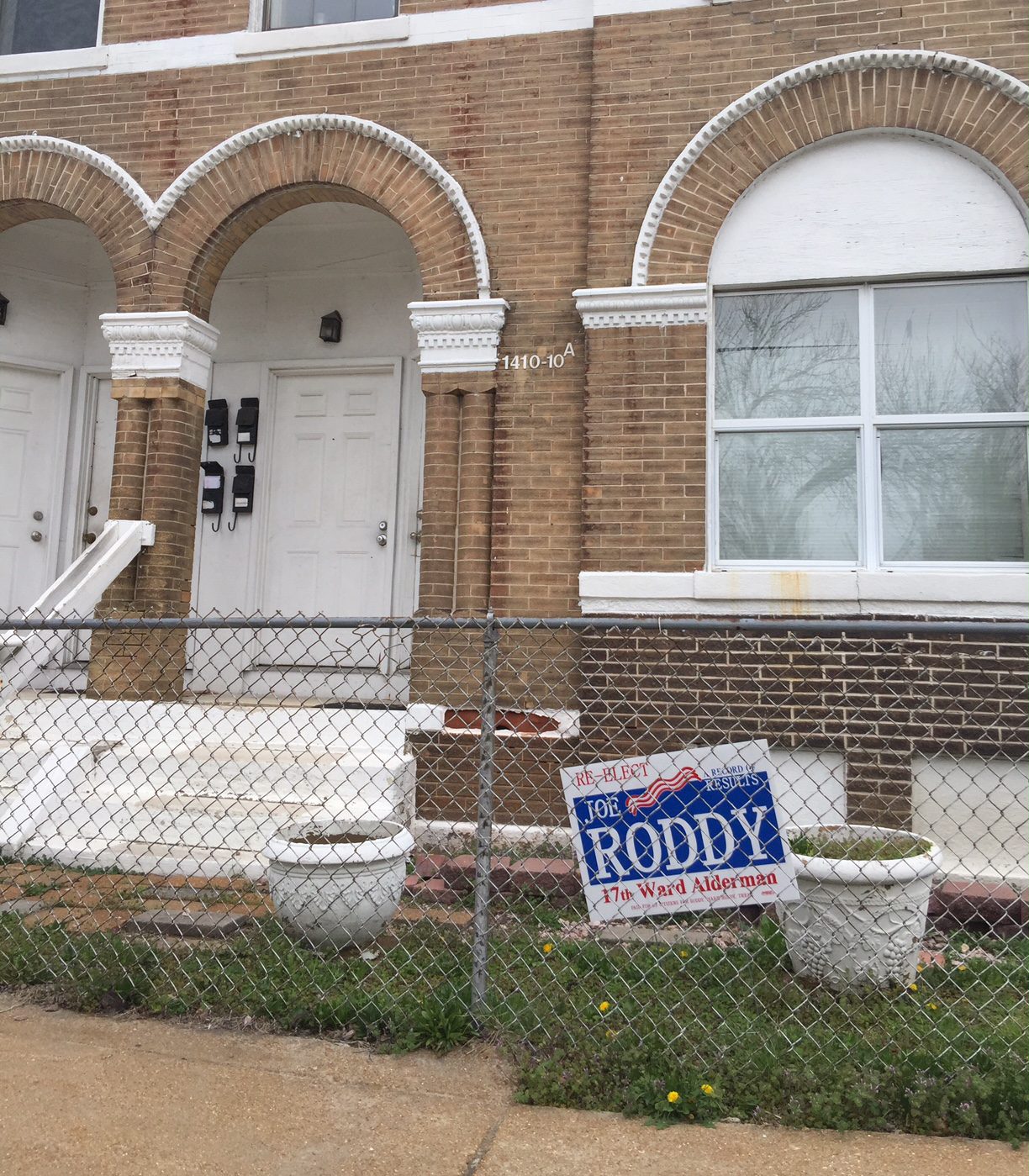
MFA requested approval to demolish a residential building at 1408-1410 Tower Grove Avenue. The structure is a merit building in a National Register district and found to be in sound condition. The demolition would have made way for a “secure employee courtyard”. It’s unclear how removing a four-unit affordable apartment building in a quickly changing central neighborhood improves the health and well-being of individuals and communities most in need.”


Even with HOK’s inventive euphemistic “flexible community zone” to label a parking lot, the project failed to win the support of the Park Central Development Corporation’s development committee. Despite this, the Cultural Resources Office surprisingly endorsed the demolition, with some creative reasoning: “The proposal by the Missouri Foundation for Health to rehabilitate the Columbia Iron Works Facility exceeds the value of the preservation of the four-family structure, which is incompatible with the proposed development for the Foundation.”
Having read Preservation Board agendas for more than a decade, I’ve never seen such reasoning, which I read as giving the go-ahead for demolition to any developer wanting to develop a different use for a sound merit building in National Register District. Basically, the justification is simply that the developer doesn’t want the building. It’s that silly.
Still, with the board could have simply endorsed the CRO recommendation over the objection of the neighborhood development corporation. Often times the ward alderman will weigh in publicly, or quietly on such issues. It’s unclear whether the Roddy campaign sign at 1408-1410 Tower Grove represents an endorsement for demo or a plea for help.
Read more: Missouri Foundation for Health Plans New Home at Columbia Iron Works in The Grove
____________________________
Bonus smart decision – the Preservation Board gave preliminary approval to the HOK-designed apartment building for the South Grand Y site:
Read more: Contemporary 116-Unit Apartment Building Planned for South Grand YMCA Site