Author's posts
Jun 20
Absent Needed Transportation Discussion, Here Comes North-South Light Rail Study
There’s a rail advocacy organization in St. Louis. There’s a regional transit entity in St. Louis. There is no transit advocacy organization.
The creation of the region’s first not-quite-heavy rail line was a huge move forward for the region. The second line opened after similar heavy lifting by rail advocates. The Blue line offers important access to Washington University in St. Louis campuses, the region’s largest and fastest growing medical and innovation district, and downtown Clayton and St. Louis County offices.
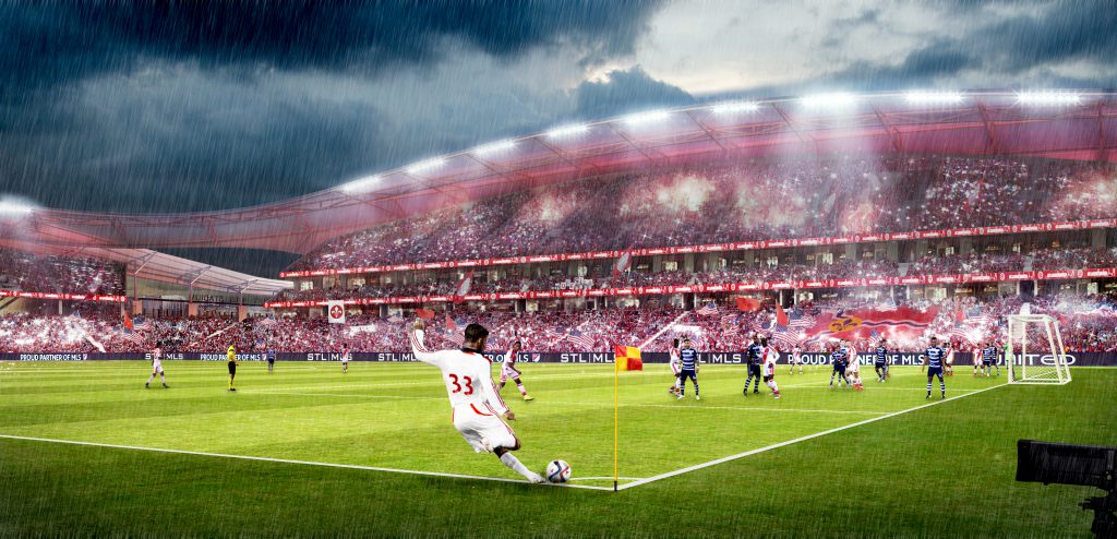
Current possible light rail route:
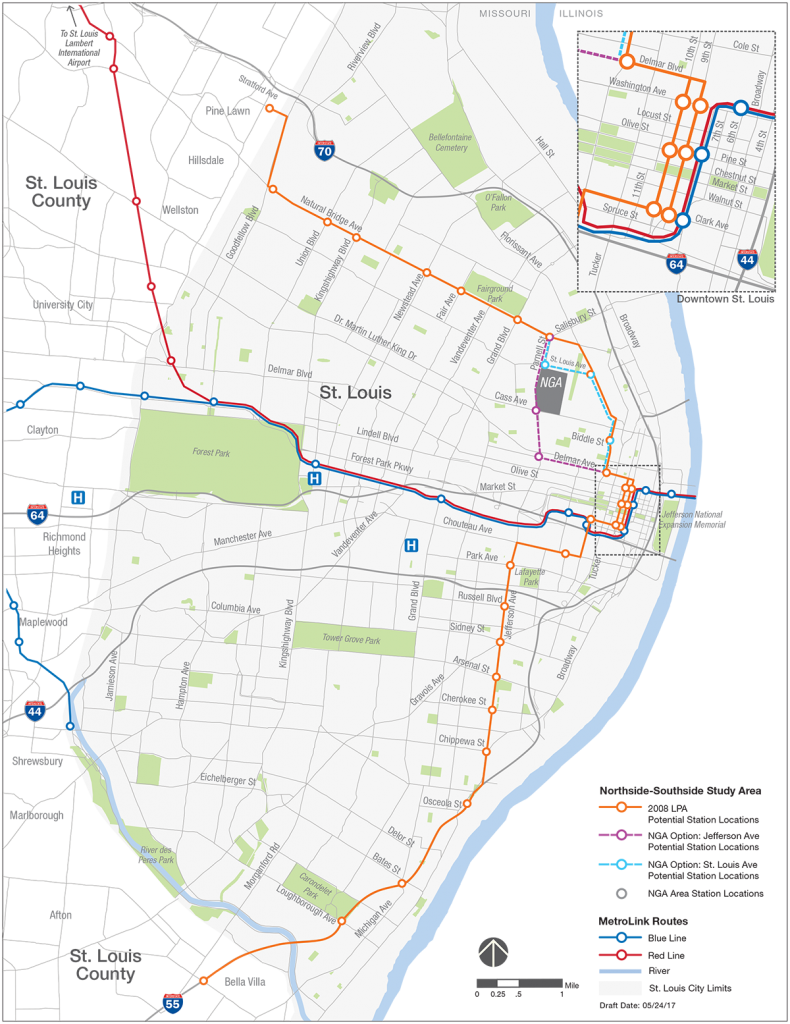
The Blue Line has been something of a farce as well. It was completed over budget, failed lawsuits added to the cost, and the really damaging part of the process has proven to be the lack and any transit development planning in the communities along the corridor. The line has been open 11 years. It opened 13 years after the region’s first (Red) line.
Of course in 2010, St. Louis County voters approved a 0.5% sales tax increase to fund transit. The vote triggered an already-passed St. Louis City sales tax increase of 0.25% for transit as well. What happened? About half of the approximate $75M of revenue produced by Prop A and the City sales tax was to be committed to restoring and maintaining Metro service. The remaining amount was to be targeted toward service expansion, bus, MetroLink and possible Bus Rapid Transit (BRT) lines. At the time of publishing, we’re not sure where the $259M committed to expansion might be.
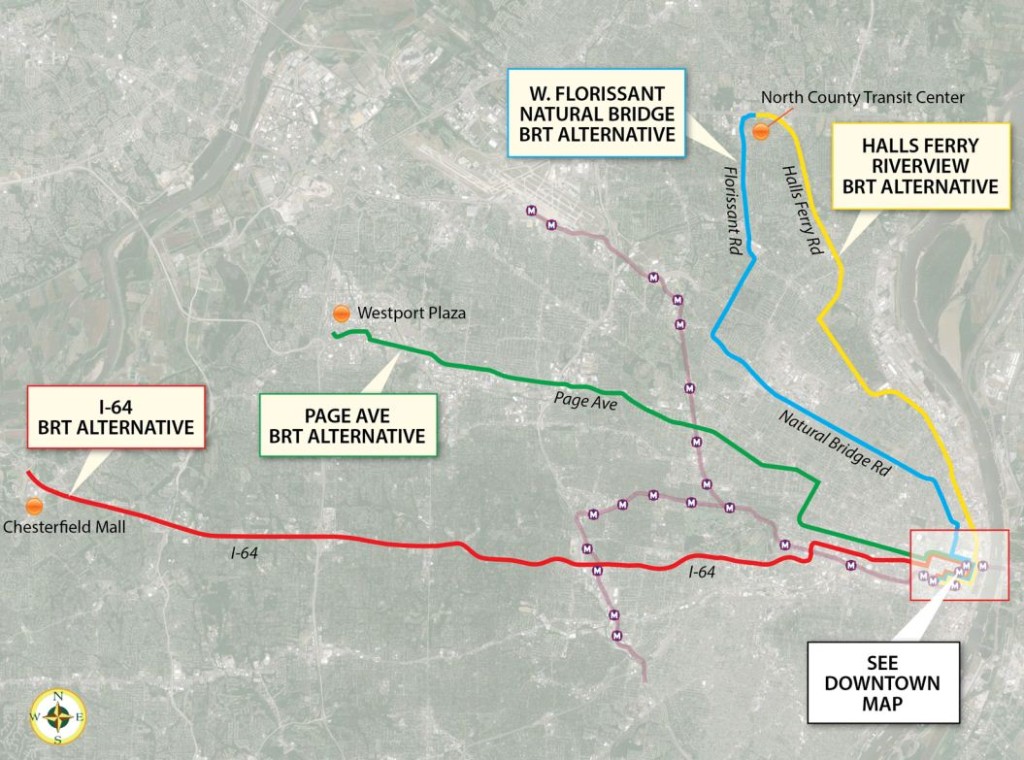
Seven years ago, Metro was awarded a $700,000 Federal Transportation Administration grant to examine the Moving Transit Forward high-speed, high-capacity transit service corridors. It was assumed at the time that a Bus Rapid Transit plan could be forthcoming. The five corridors identified in early planning included a Grand Avenue line as well as options for I-55, I-44, I-64, and I-70. Planning was to be completed by fall 2011.
Possible bus rapid transit routes:
In 2013, a $200,000 light rail study was completed. The environmental assessment was projected to be completed in 2014. The optimistic timeline on that rail line? Construction was said to start as early as 2015, with the line opening in 2016.
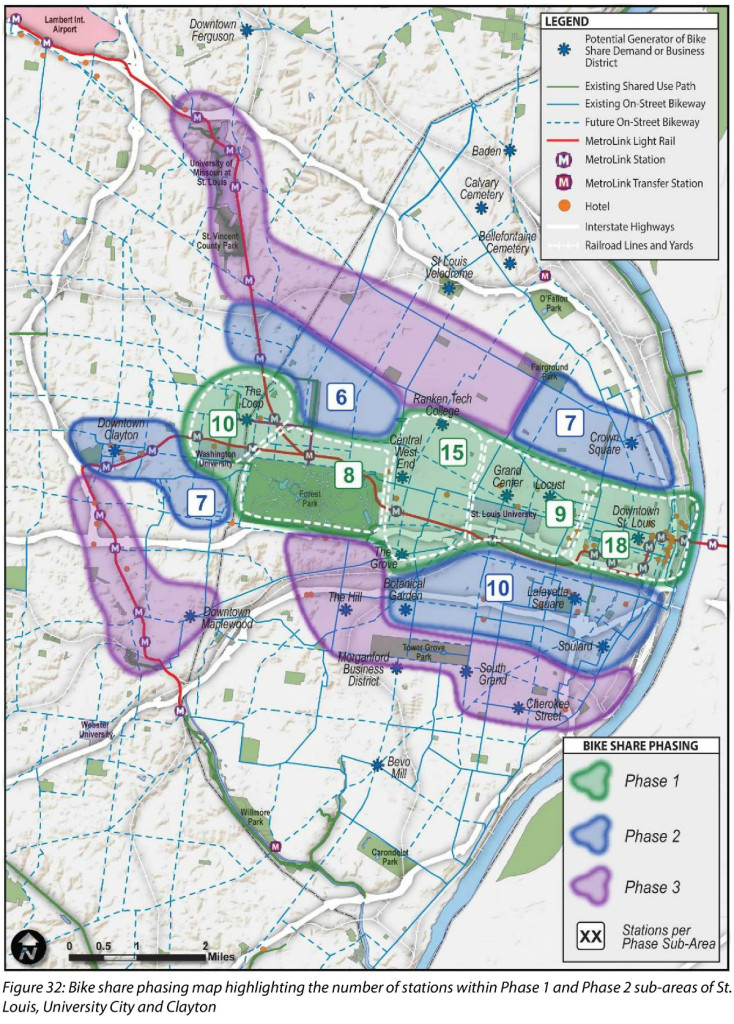
In late 2014, a 60-station bike share study was released for St. Louis. The study concluded with “In the next two to three years, St. Louis will place itself within a growing group of US cities that have made their cities a better place to live, visit and explore through bike share.” The bike share plan isn’t dead, but there’s been no observable progress.
So, so what? As there’s still no pedestrian or bicycle advocacy organization in St. Louis, no group dedicated to the betterment of bus transit, the money and talent that cares about transit is getting ready for another round of rail expansion. That new effort is now live online: NORTHSIDE-SOUTHSIDE
LIGHT RAIL FOR THE ST. LOUIS REGION
This site has been a big supporter of the promise presented by a north-south rail line primarily within the City of St. Louis. But even assuming this effort progresses smoothly and quickly, St. Louis transit planning will still be greatly lacking. We may have another rail line in 5-10 years, but when will the city and region care about more than rail?
Jun 09
Friday Live Chat – nextSTL
Jun 08
American Graffiti – nextSTL
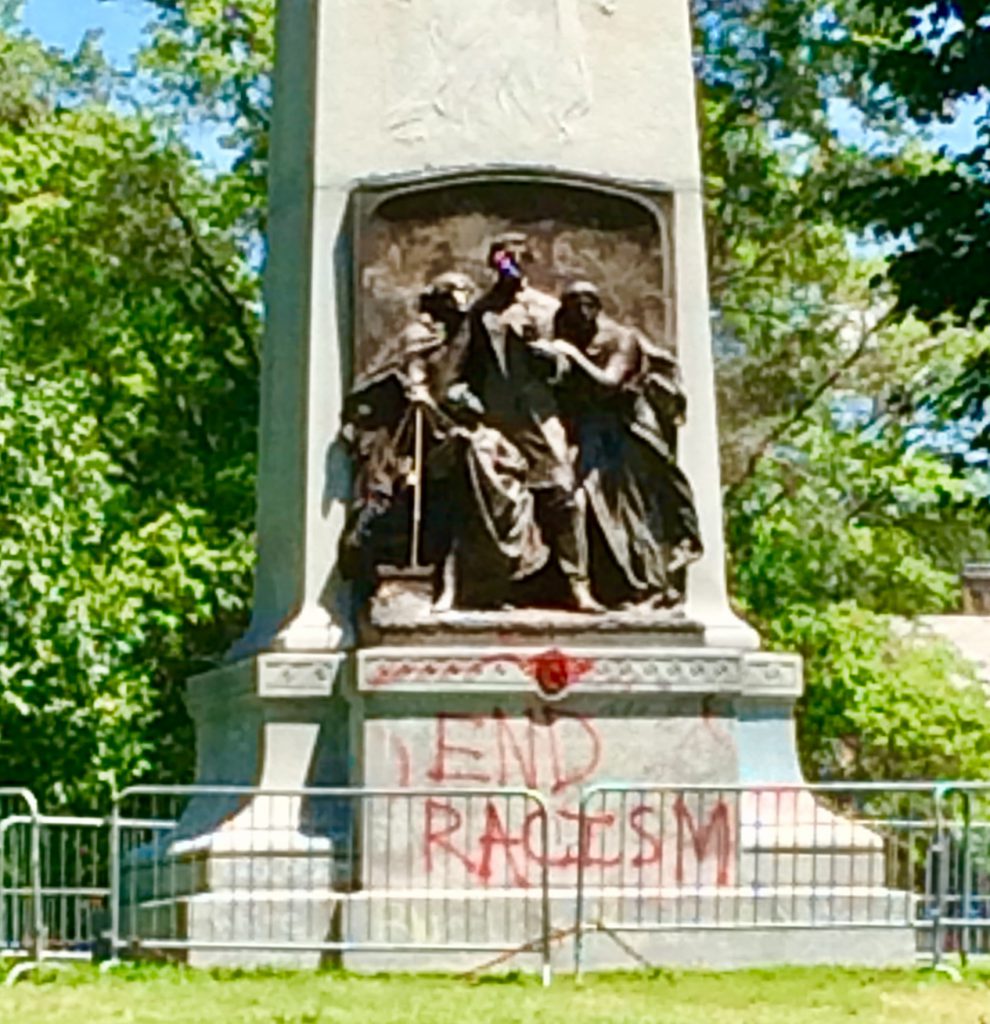
On the night of May 23rd, someone spray-painted the Confederate Memorial in Forest Park, a monument that depicts a white family sending a soldier off to fight in the Confederate war effort. The graffiti included an anarchist symbol painted over the soldier, a Black Lives Matter placard positioned behind the family’s heads, and phrases like “Stop Defending Injustice” and “This is Treason” on the monument’s base.
The St. Louis Parks Department was on the scene the very next morning removing the placard and scrubbing off the paint.
Two years earlier, in the wake of the June 2015 massacre at the Emanuel AME Church in Charleston, individuals spray-painted the Confederate Memorial in Forest Park. They wrote “Black Lives Matter” and “Fuck the Confederacy” on the base and splattered the inscription with red.
The next morning authorities scrubbed off the paint.
In both cases, graffiti is not beside the point, nor so readily scrubbed away. While the monument depicts white experience, that’s not all it depicts. Graffiti gives expression to the thing that, by its very absence from the monument, is shouting at us: the matter of African American experience, and especially the violence to which black lives under white supremacy have long been, and continue to be, subject. Leaving the Confederate Memorial in place, unscrubbed and unsanitized, with its graffiti in full view, would serve to “[right] the wrong image these monuments represent and [craft] a better, more complete future for all our children and for future generations,” the worthy goals cited by New Orleans Mayor Mitch Landrieu in his justification for the removal of four Confederate monuments in that city.
The well-intended impulse to bury such monuments, à la Mayor Landrieu, or to preserve them as museum artifacts, as some have proposed, is analogous to the misguided impulse to celebrate them. Thinking of the memorials and such graffiti together, removal has the effect of hiding black bodies and black trauma from public view.
We need graffiti. Indeed, to accomplish what Landrieu is calling for––taking the Confederacy off its “pedestal in our most prominent places of honor”––we need to acknowledge the trauma, rage and rejection graffiti expresses. Taking down a monument that represents toxic histories erases it as a site of living struggle, defeating historical understanding and full democratic ownership of the American past.
Yes, these monuments have a painful, even traumatic impact on many viewers; they represent a celebration of violence and white supremacy. But Black Lives Matter graffiti on a monument does more to advance public healing and understanding than no monument at all.
Healing requires not only a willingness to confront what the memorial represented in the past––the views and interests of defenders of the Confederacy––but also to interrogate the motives behind today’s frantic calls for removal. The stakes of St. Louis’s monument controversies and those of other cities such as New Orleans and Baltimore include the matter of who controls urban space, and how it is used. As terms like ‘defacing’ and ‘vandalism’ suggest, those stakes also concern the sanctity of public and private property. Officials who call for the scrubbing or relocation of such monuments mean not only to sanitize their city’s reputation, but also to discourage future ‘vandals’ from making claims. Their actions reveal an interest in maintaining urban public spaces as precincts of order, respectability, and uncontroversial history––which is to say no history at all.
The monument controversies sweeping the cities of the New South are fundamentally existential ones: they concern what anthropologist Mary Douglas called purity and danger. There is inherent risk in a public life in which memorials can become sites of political-historical engagement––where debate flows freely and authorities and citizens are willing to call into question sacred values of all kinds. We must ask: do the dreams of development in post-Ferguson St. Louis (as in post-Katrina New Orleans) mandate purification of public space and public memory, and foreclosure of ‘dangerous’ uses of either?
On Tuesday, May 30th, St. Louisans awoke to learn that the freshly-scrubbed Confederate Memorial had been marked again––this time with “End Racism,” “Black Lives Matter” and “Nat Turner Lives.” That night police patrolled the area and shined a high-powered spotlight on the monument, now surrounded with crowd control barriers––apparently an effort to prevent “vandalism” and other contentious activity at the site.
This cat-and-mouse game will soon come to an end: city authorities are preparing to remove the monument from the park. But we’re living through a classic moment of democratic disruption. St. Louis has had to attend to the matter of Confederate memory before it could continue the work of urban progress. It has had to ask itself: Is it the city that preserved the Confederate Memorial? Is it the city that removed the Memorial? Is it a city where ad hoc acts of public memory––including not only monument graffiti but also protest and graffiti at the Ferguson QuikTrip in the aftermath of Michael Brown’s death, and temporary memorials at the site where his body lay for hours on Canfield Drive––shape the stories of progress it can tell?
The Confederate Memorial, still intact at this writing, should be left alone, along with its graffiti: This does not represent capitulation to those who would celebrate the Confederacy, but rather an acknowledgment of the messy and violent histories embodied in such sites which will always defy efforts at either consecration or cleanup.
Jun 07
Centene Corporate Auditorium, Parking Garage Design Revisions Presented
Design for the largest project downtown Clayton has ever seen continues to evolve. While the most anticipated elements of Subdistrict…
Jun 06
MLS Expansion: St. Louis vs. Cincinnati
As St. Louis awaits a possible Plan B to become a Major League Soccer city, Cincinnati is squarely aimed at Plan A. There are a dozen cities hoping to become an MLS city, but no two are quite so similar to one another as the Queen City and the Gateway to the West. Of course, they are also the two with which I am most familiar.
Prospective ownership groups in each city have followed a similar road. Saint Louis FC was founded in 2014, FC Cincinnati, 2015. Both play in the USL. However, Saint Louis plays in a 5,500-seat suburban industrial park stadium. Cincinnati plays at the University of Cincinnati’s Nippert Stadium, a top-tier 35,000-seat college football stadium, about two miles from downtown.
While enjoying similar on-field success, Cincinnati has set the USL attendance record several times, most recently against Orlando City B at 24,376. An exhibition game against Crystal Palace drew 35,061. Larger crowds have witnessed soccer at Busch Stadium and the Edward Jones Dome in St. Louis, though those matches didn’t involve Saint Louis FC. Whether due to circumstances or planning, Cincinnati has clearly established a following not enjoyed by Saint Louis. One must assume that this matters when asking for public money.
St. Louis is on to Plan B because a vote to support an MLS expansion bid by a group led by Saint Louis FC CEO Jim Kavanaugh, fell a few percentage points short (47/53 or 3,300 votes) of committing $60M toward a stadium. Only St. Louis City voters were asked to vote on a contribution of public money. The prospective ownership group spent $1.18M on that effort.
Just getting the measure on the ballot saw plenty of drama and politics. The proposal eventually fought its way through the city’s 28-member legislative body, of which, only one represents the stadium site. Though not exactly a competing measure, voters weighed in on a transit and public safety tax as well. Its passage was required for the MLS funding to pass.
In Cincinnati, the expansion effort is being led by Carl Lindner III, CEO of FC Cincinnati. Where the St. Louis effort required bringing in a big outside investor to do the heavy financial lifting, the Cincinnati effort is locally led. For those in St. Louis, the Lindner family is to Cincinnati what a blended DeWitt and Taylor family would be to St. Louis.
And while the soccer fans in St. Louis know and appreciate the Kavanaugh name, and Dave Peacock, is well, someone everyone’s gotten to know through the NFL stadium effort, Mr. Lindner needs no introduction in Cincinnati. This gives the effort a different premise.
In St. Louis, the stadium was sold as an economic development tool. It promised 450 construction jobs and 428 permanent jobs. Perhaps St. Louis City voters had grown cynical after four professional sports stadiums didn’t revitalize the city, or their neighorhood. And it hasn’t just been stadiums, big project after big project has promised to alter the trajectory of the city. They haven’t.
In St. Louis, the stadium site was decided out of the public view, as such things are done. The proposal was all wrapped up and decided upon before given to voters as an all-or-nothing proposition, as such things are done. As the NFL stadium effort was done.
In Cincinnati, there’s no expectation that the process will be fully democratic, but there’s a relatively huge engaged fan base that expects to be involved. In fact, season ticket holders will be presented with an “innovative” stadium design by Dan Mies at a June 12 event.
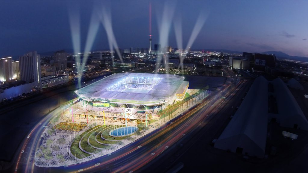
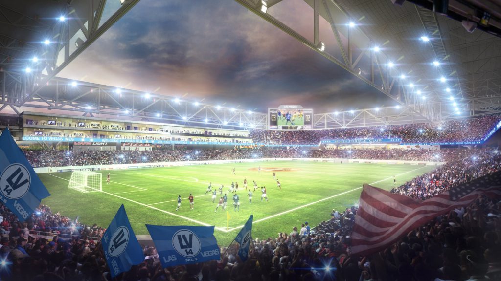
Mies previously designed a pro soccer stadium for the Las Vegas effort. Architectural design may be subjective, but Mies’s Vegas design is better than the HOK effort in St. Louis. While they may be getting the design/site process a little backward, three potential stadium locations are being publicly debated, if not publicly decided. The process has a different feel.
Dan Mies Las Vegas MLS stadium design:
But what matters, what is clear, is that the MLS wants what’s best for the MLS. While the league may very well want to be in St. Louis, whether or not that happens is up to a prospective ownership group. An expansion franchise depends on a stadium deal, with or without public money.
Again, the parallels here between St. Louis and Cincinnati are significant. Both ownership groups have touted $250M in private investment and a $200M stadium. However, the St. Louis group stumbled on the MLS expansion fee, publicly penciling in $200M, then not adjusting the public ask when the fee was confirmed at $150M. The public vote in St. Louis was rushed, as such things are done.
The contortions may only be beginning in Cincinnati, and a public ask in some form is coming. A new pledge from the prospective ownership group of no new tax increase has been made, leaving the source of public funds unanswered. The best guess is that the group is targeting a current tax that funds the NFL Bengal’s Paul Brown Stadium. There could be other options.
Both cities have had painful NFL stadium deals, with Cincinnati (Hamilton County) owning perhaps the worst deal ever made. That said, there is still an NFL team in Cincinnati. And that is likely because Cincinnati is in Hamilton County. (Sidenote: while St. Louis City owns Scottrade, home of the NHL Blues, US Bank Arena in Cincinnati is privately owned, and is currently in a stalemate as political leadership has clearly stated no public funds will be used in its needed renovation)
St. Louis City and Cincinnati share similar histories and today exhibit similar attributes of size, population, and demographics, but there’s one defining political difference. Cincinnati is the seat of Hamilton County. St. Louis City is its own County and Clayton is the seat of St. Louis County.
Hamilton County has lost near 13% of its peak 1970 population over the past 40 years. Over the same period, a combined St. Louis City and County lost 16%. These are very similar places, save the political fragmentation.
Ultimately, regional political fragmentation pitted St. Louis County against St. Louis City. The work required to adequately address multiple political constituencies wasn’t completed. Shortcuts were taken. It’s quite easy to imagine that is the April vote in St. Louis had been put to St. Louis City and County voters, the outcome would have been different.
It’s not clear if Hamilton County voters will be asked to sign off on public money, or if the mayor and city council (which consists of nine members, each elected at-large, that is, they each represent the entire city and not a ward or district) could approve funding. Of course, the Cincinnati effort may still stall, but on the ground here, it doesn’t feel that way.
May 30
Loop Trolley Corridor Photo Tour: Delmar from Limit to Kingsland
Let’s continue our tour of the Loop Trolley corridor heading west along Delmar from Limit.
See the first installment: DeBaliviere
See the second installment: Delmar East of Des Peres.
See the third installment: Delmar from Des Peres to Limit
 We’re in University City now. I feel much safer. We see some of the effects of #fragmentation.
 The trolley stop at Limit. Here the platforms have the fancy texture unlike the ones in St. Louis.
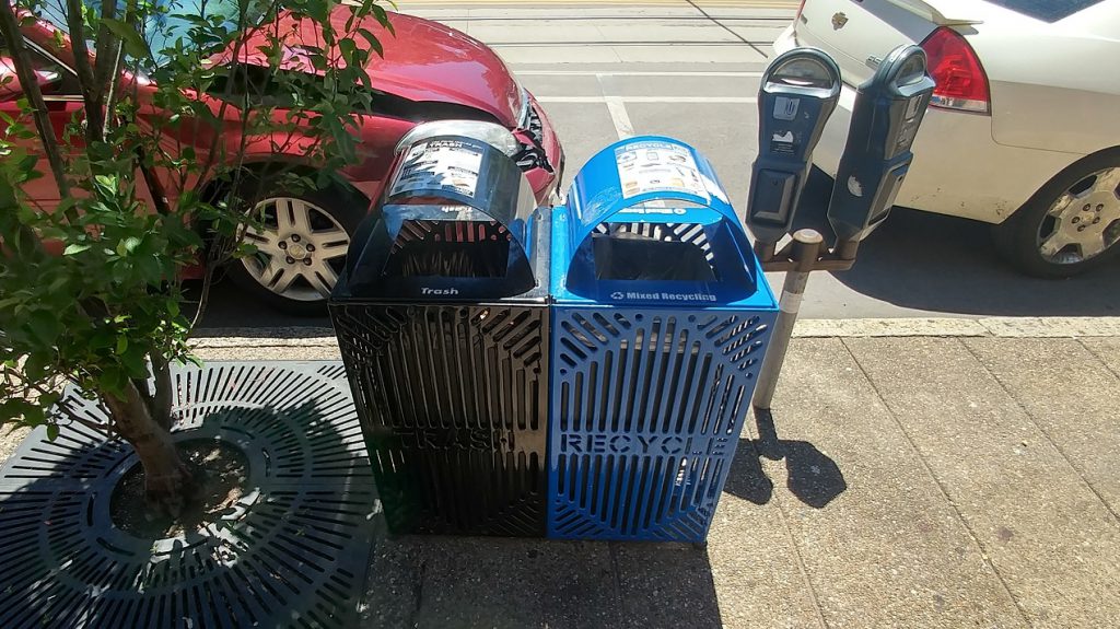 U City has put out dual trash-recycling bins. Something to copy on the city side. U City still has old-timey parking meters.
 The intersection of Westgate and Delmar. It has a couple of the corner curb cuts.
 Melville at Delmar. Now this is the right way to do curb cuts!
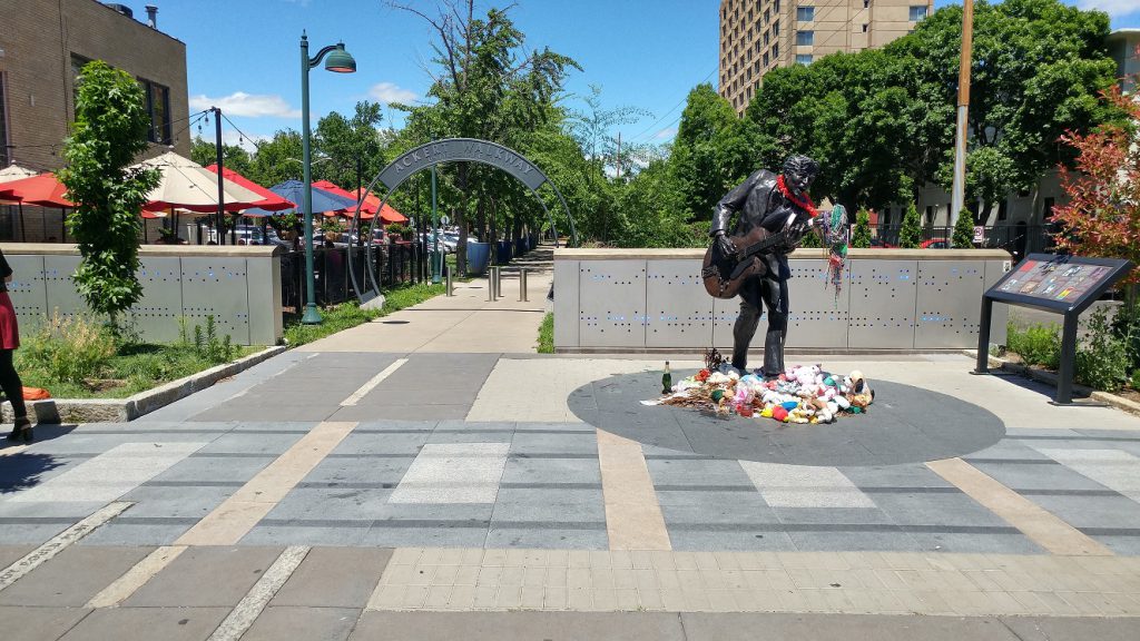 Ackert Walkway, part fo the Centennial Greenway, and Chuck Berry Statue.
 The Trolley stop at Leland.
 THe most awkward set of curb cuts on the Trolley corridor. The west one takes you way out of your way and the east one makes you deal with an obstacle course. Why is this so hard?
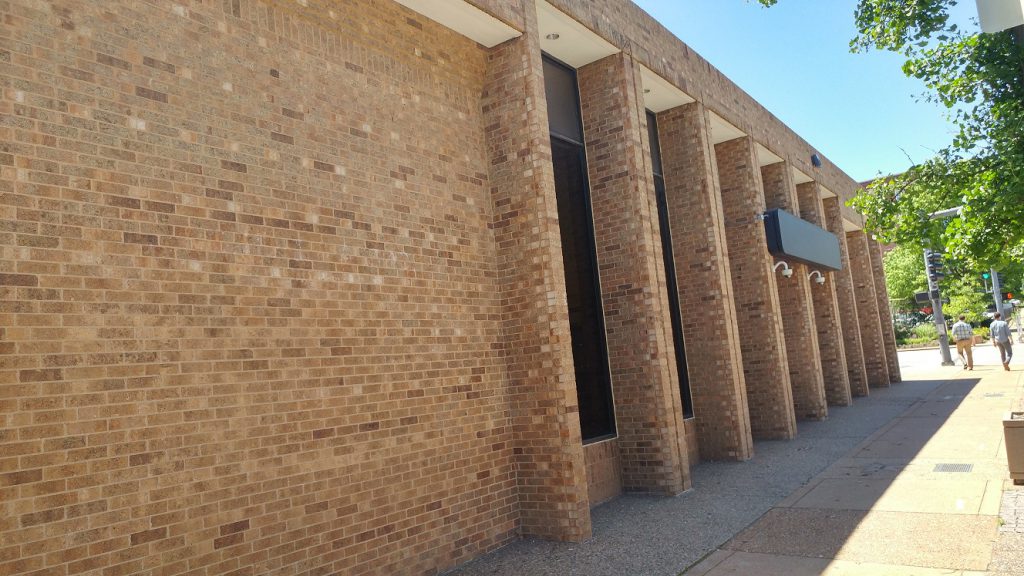
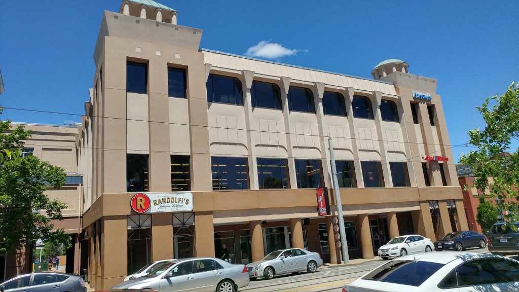 American National Insurance Building. This building has an interesting history. I dislike how confining the colonnade is.
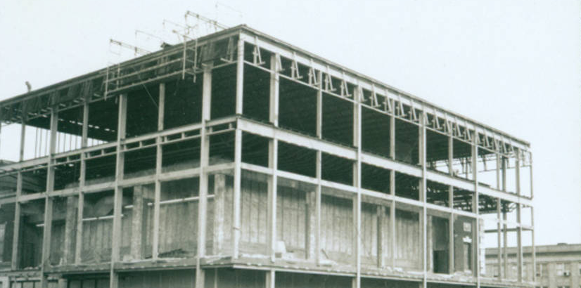 The building was stripped and a third story was added during the urban renewal era.
 I never understood why this building wasn’t set back to line up with the adjacent building. The sidewalk is too narrow.
 6680 Delmar. The 5/3 Bank branch that never was.
 The Trolley stop at the University City Library.
 The end of the line. It was once planned to do a loop around the roundabout to the west.
That concludes our tour!
About Richard Bose
May 25
Five Townhomes Proposed for 10th and Locust in Downtown St. Louis
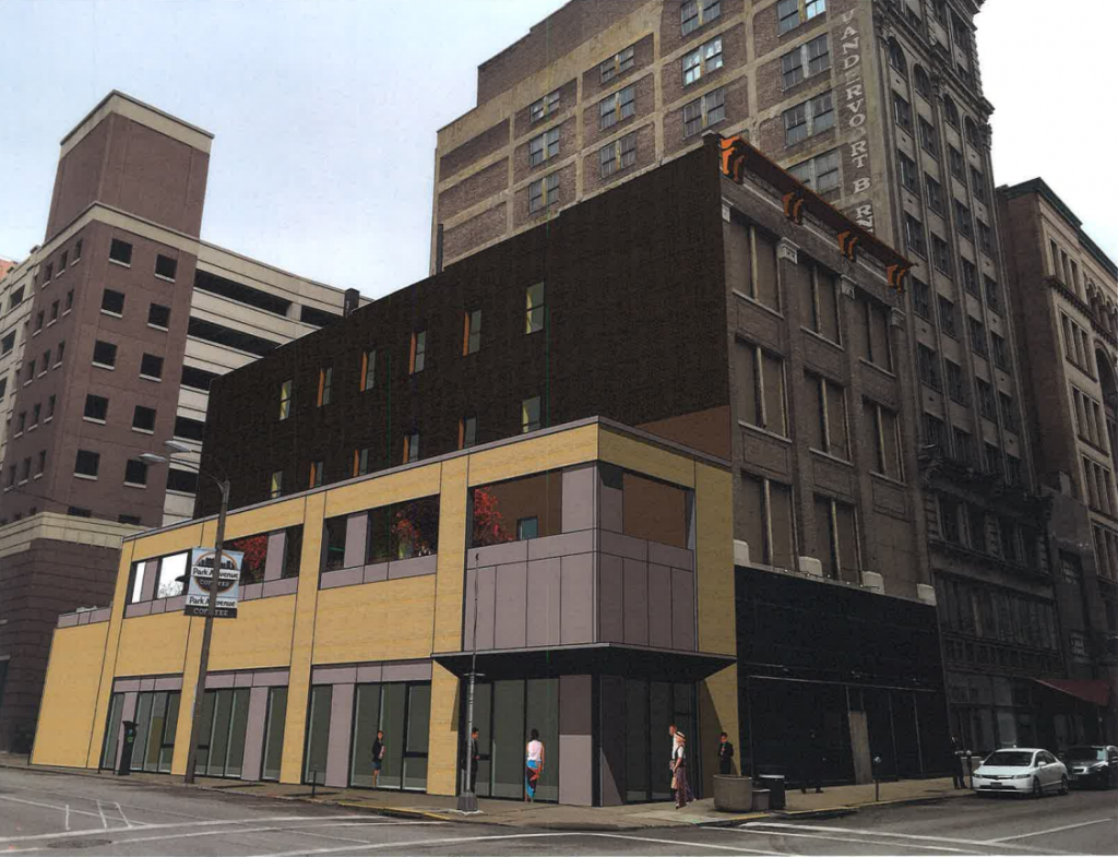
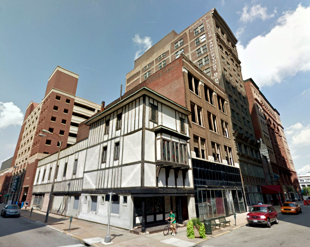
Plans for the corner of Locust and 10th Streets in downtown St. Louis have taken another turn. While demolition of the historically significant reclad Tudor building has been sought by more than one developer, what might replace it has changed and changed again. Now, TWG Development of Indianapolis is proposal five townhouses. The scale and massing closely mimic the existing building.
The plan for townhouses that would appear at first glance more at home in a city neighborhood like Dogtown, Benton Park, or elsewhere, is interesting. Townhomes as shown would introduce a new housing option in the heart of the central business district. The expectation on a lot such as this would more often be to build taller. That may be limited by the desire to have windows on the adjacent building and the small dimensions of the lot.
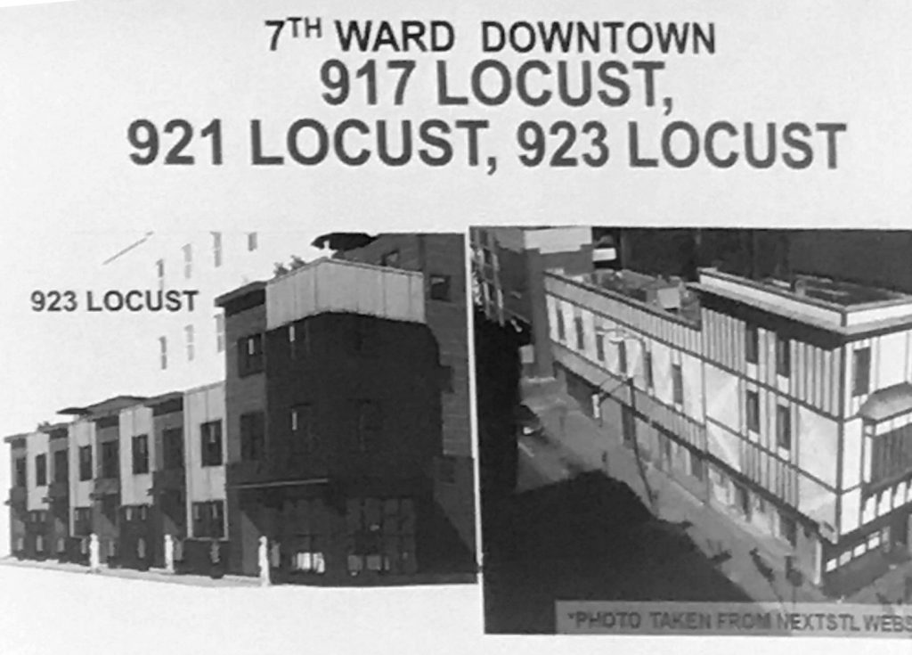
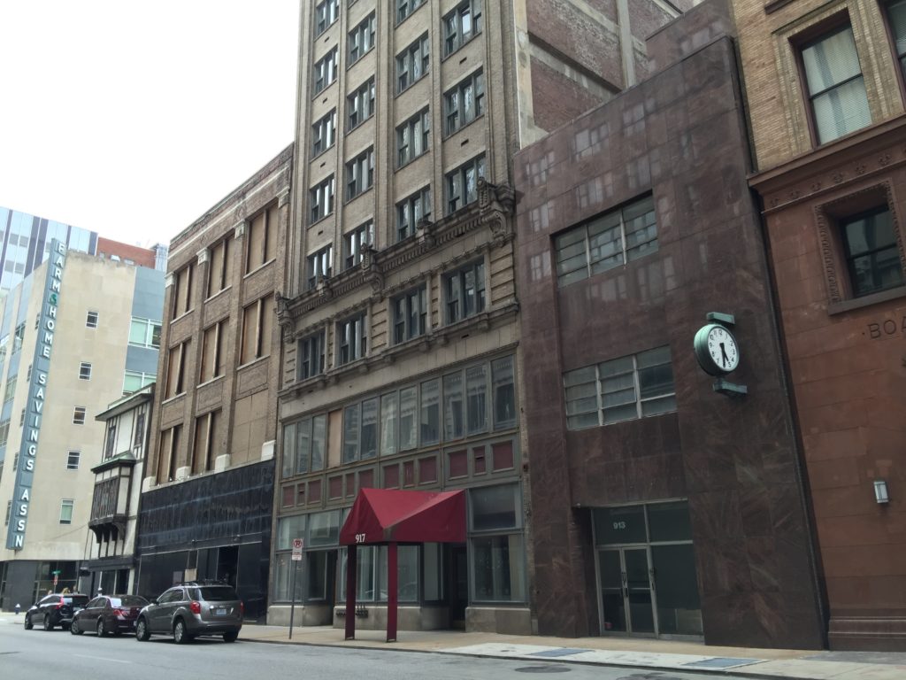
NEXT STL was the first to report on the larger TWG project comprised of four buildings from 913-921 Locust. The properties were purchased from UrbanStreet, which had acquired the properties as part of a package deal with that included the Orpheum Theatre and the Roberts Tower. The Orpheum was recently sold to Jubilee World. The Roberts Tower has been converted into apartments.
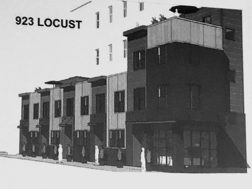
In March we learned that work on the larger buildings would commence soon, but the fate of the corner building remained unknown. An earlier rendering by TWG of new construction mixed-use building to replace the existing Tudor structure (NEXT STL story):
913-921 Locust:
From our previous reporting:
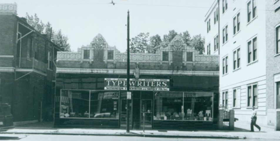
Initial plans call for the replacement of the corner building at 923 Locust with a new retail building. The existing building is well known for its late 1940s Tudor style makeover. nextSTL has chronicled the building’s interesting history as an art gallery in this profile: When the Art World Came to St. Louis.
Planning is at an early stage, but if all the benchmarks are met, work could begin in Spring 2017. TWG recently completed an historic renovation project with some similarities in Indianapolis. The 14-story Penn Street Tower opened after a 20-year vacancy as 98 apartments last year. The 185,000 sf, 1913 building was renovated at a reported cost of $14M.
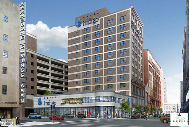
Several years ago, the Roberts brothers planned to demolish the two Locust Street buildings nearest 10th Street (919-921, and 923 Locust) and construct a two-story lobby and entrance for a Hotel Indigo. The plan represented a reasonably urban corner, though introducing a guest drop-off driveway as well. Needless to say, that plan disappeared along with the Roberts empire.
Roberts brothers Indigo Hotel rendering:
May 25
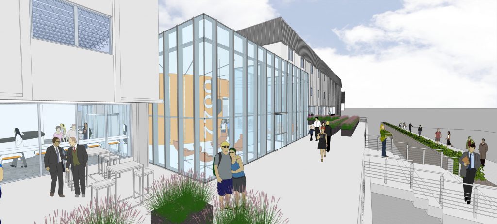
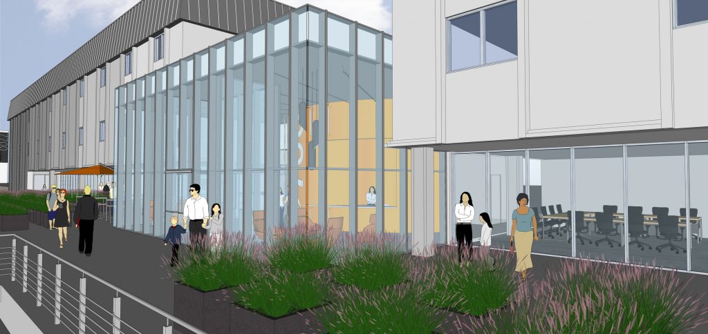
New Renderings by JEMA Studio Show Planned 7700 Clayton Transformation
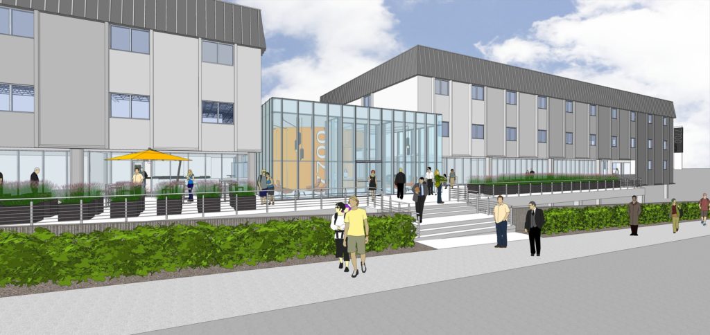
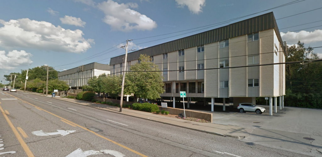
Plans for a reimagined 7700 Clayton Road are being developed by JEMA Studio. The unremarkable 52,000 sf building was recently acquired by Bamboo Equity Partners for $4.4M.
The building, located in Richmond Heights, aims to serve the need for small office suites in the larger Clayton area office market. The transformation has a budget of approximately $3M.
From JEMA Studio:
Bamboo Equity, a leading real estate investment firm in St. Louis, has hired JEMA to be the architect and interior designer for the renovation of the 7700 Clayton Building located at the intersection of Hanley Road and Clayton Road. The existing building was constructed in the 1970s and will undergo a complete transformation.
A glass “box” entry and renovated entry plaza create a new entry experience for the building and a new “face” along Clayton Road. The glass “box” contains the building’s collaborative areas: coffee shop, conferencing spaces and lounge.
Initial rendering of the new 7700 Clayton Road:
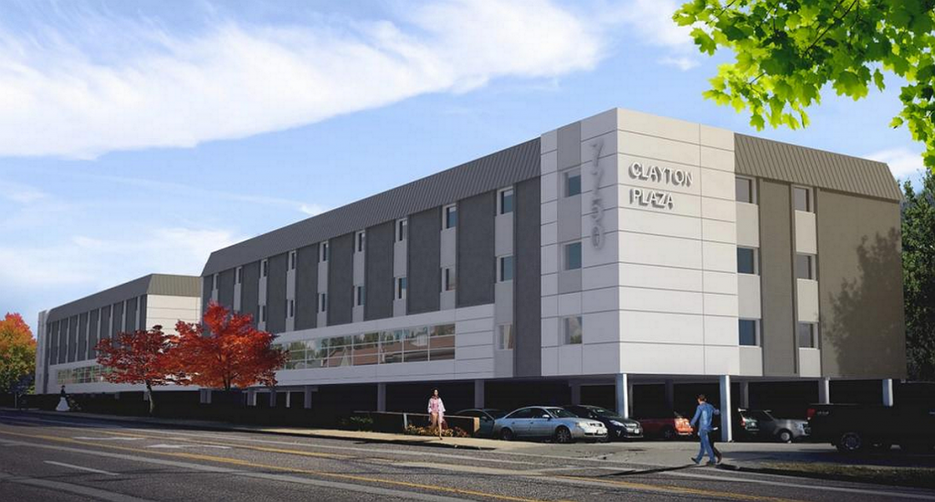
7700 Clayton Road today:
About Development Ticker
May 24
We Built a Transit-Compatible Place and Removed the Transit
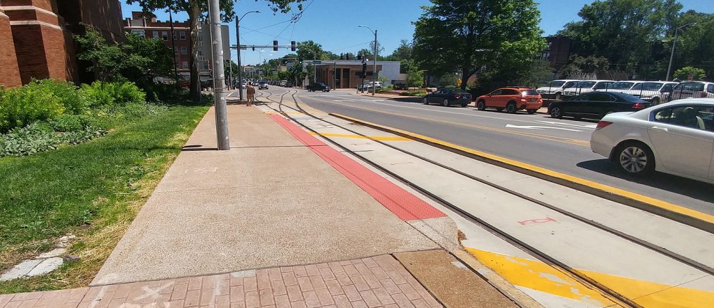
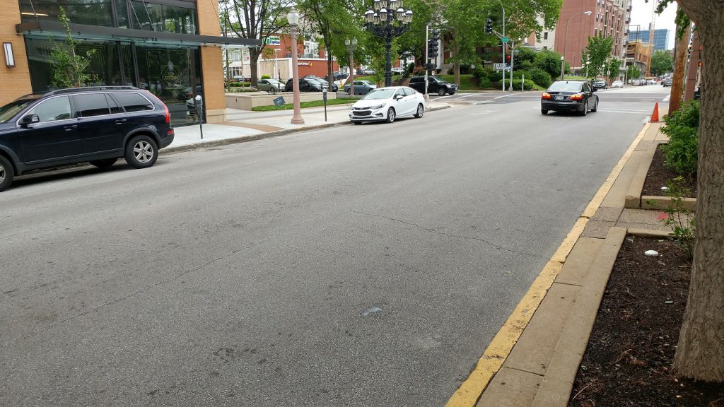
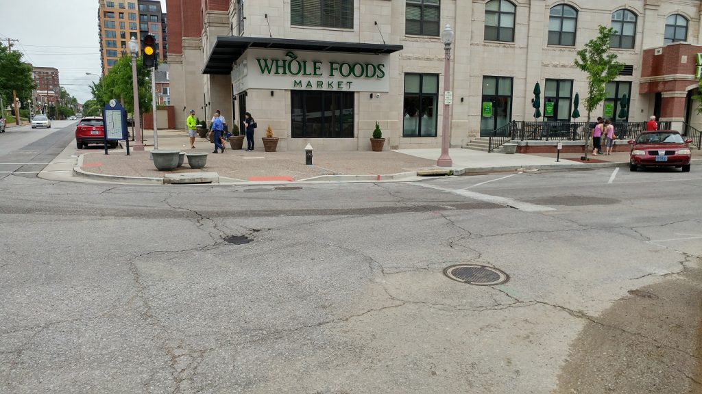
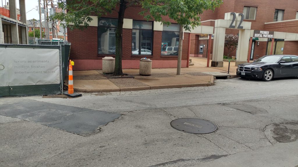
Transit works best when it delivers you to and takes you from the middle of things instead of the edge of things (for example Metrolink in Clayton missed the mark by not putting the station at Central and Forsyth). The Central West End has been the region’s premiere walkable neighborhood for quite some time and has been getting even more walkable. A goal of development, as stated by Alderman Roddy, has been to create car-optional places. We see that in action on Euclid south of Lindell. That’s why it’s regrettable that there is no longer bus service on that part of Euclid.
I asked about it on Metro’s monthly live chat. The #1 bus used to run down Euclid. The route changed due to all the construction. I figured it would return after the Orion and Citizen Park were done. Apparently not. Ray Friem, Executive Director of Metro Transit said,
at this time, Metro does not plan to return the routing of the #1 Gold to its former routing on Euclid. There is considerable difficulty obtaining space for bus stops, and the narrow streets and heavy traffic make bus operations difficult. Instead, Metro is providing service on Taylor.
I say bunk. Catching a bus on Taylor (which is served by the #18) adds at least a 1000 feet (the length of blocks in St. Louis is a whole other problem!) to reach a bus stop from Euclid. Not a burden a transit agency interested in boosting ridership would place on potential riders. Discouraging bus ridership only worsens traffic. It’s safer to walk to a stop and wait on Euclid where there are more eyes on the street than Taylor. Euclid is just as narrow there as it is north of Lindell where it continues to run. There are many obvious places for bus stops. There are several curb bump-outs that could be used.
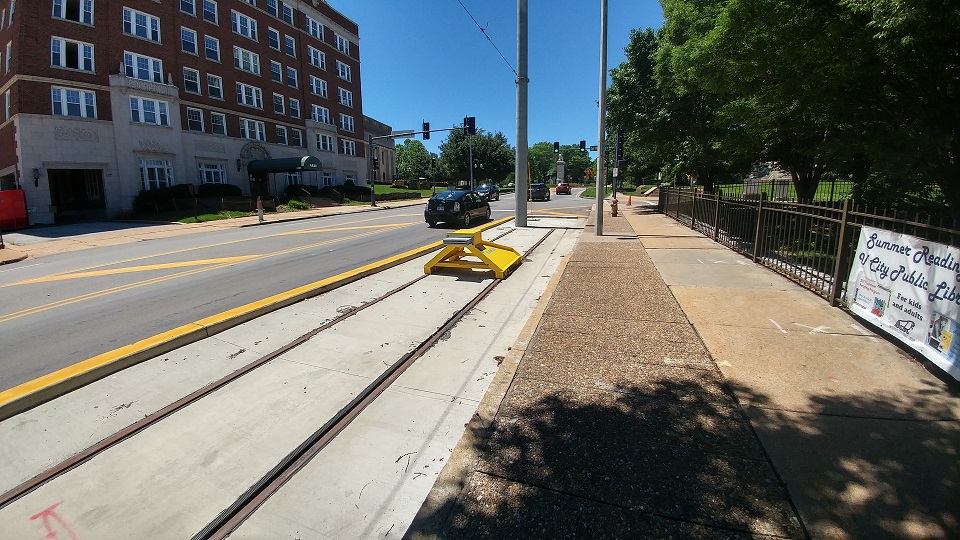
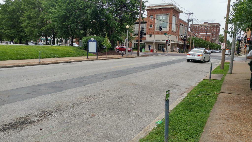
 A stop for the EB #1 used to be at the Schlafly Library. Bus service to a library is a good thing. The curb is painted yellow already so no street parking spots would be lost. A stop for the WB #1 used to be across the street.
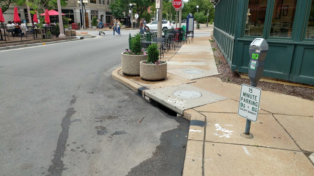
 Euclid south of Lindell. The WB #1 could stop here if immediately north of Lindell is a no go.
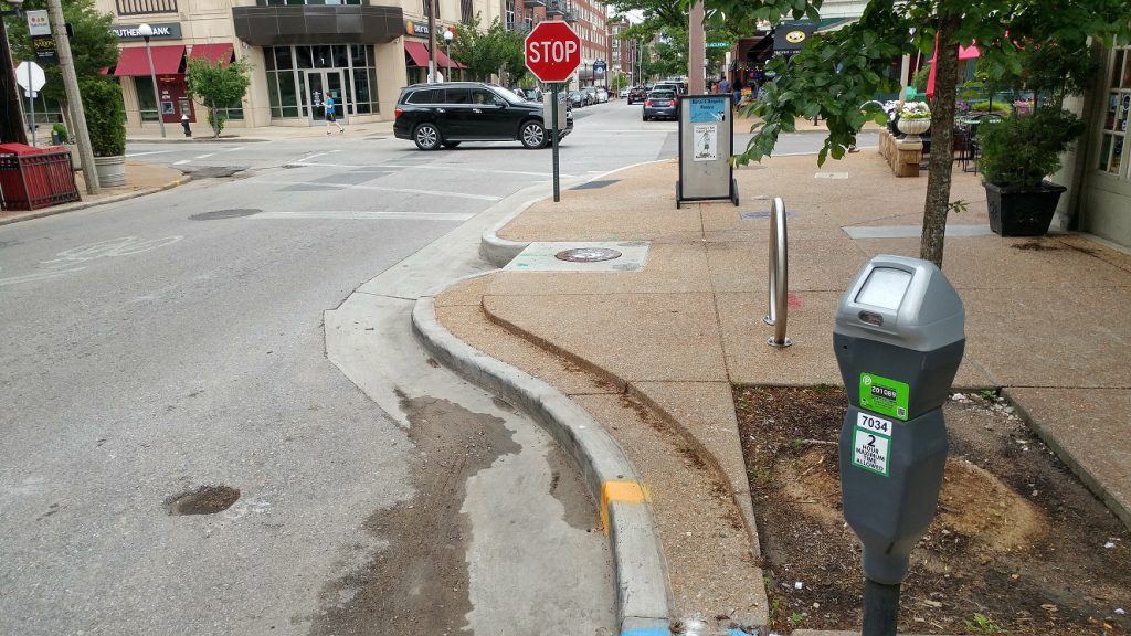
 The WB #1 used to stop in front of what is now the Orion. If that’s too hard it could use Laclede instead of West Pine to reach Euclid from Taylor.
 A stop for the EB #1 used to be at West Pine.
 There are curb bump-outs mid block between West Pine and Laclede that could be bus stops.
 Curb bump-outs could be stops for the WB #1 if coming up Euclid from Forest Park Ave or coming west on Laclede. Or put stops on Forest Park Ave that are shared with the 10 and 95.
 How about three sets of bus stops? Why do we make this so hard?
About Richard Bose
May 21
Loop Trolley Corridor Photo Tour: Delmar from Des Peres to Limit

 0
0 0
0 0
0

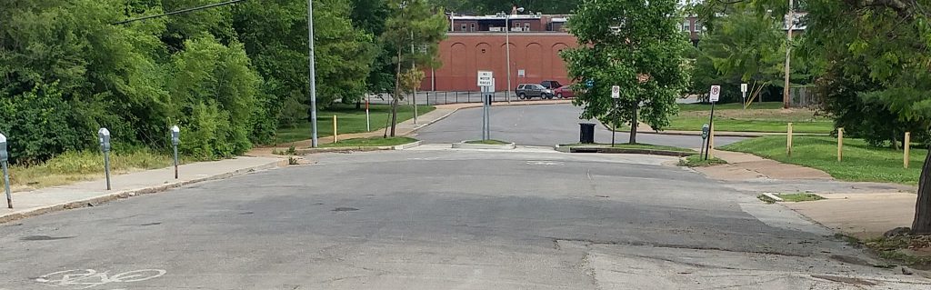
Let’s continue our tour of the Loop Trolley corridor heading west along Delmar from Des Peres.
See the first installment: DeBaliviere
See the second installment: Delmar East of Des Peres.
Things pick up as one heads west. There is a lot of litter especially in front of the inactive properties.
 Des Peres is blocked for cars, but not bicycles. Townhomes are planned for the lot on the right.
 Redevelopment opportunity at 6045 Delmar
 {H3 Studio} The Skinker DeBaliviere Neighborhood Plan shows an ambitious vision for redevelopment of the area.
 Rosedale Building waiting for new life.
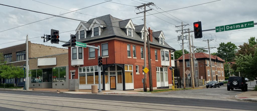 The southeast corner of Rosedale and Delmar. Anyone remember a time when this was active?
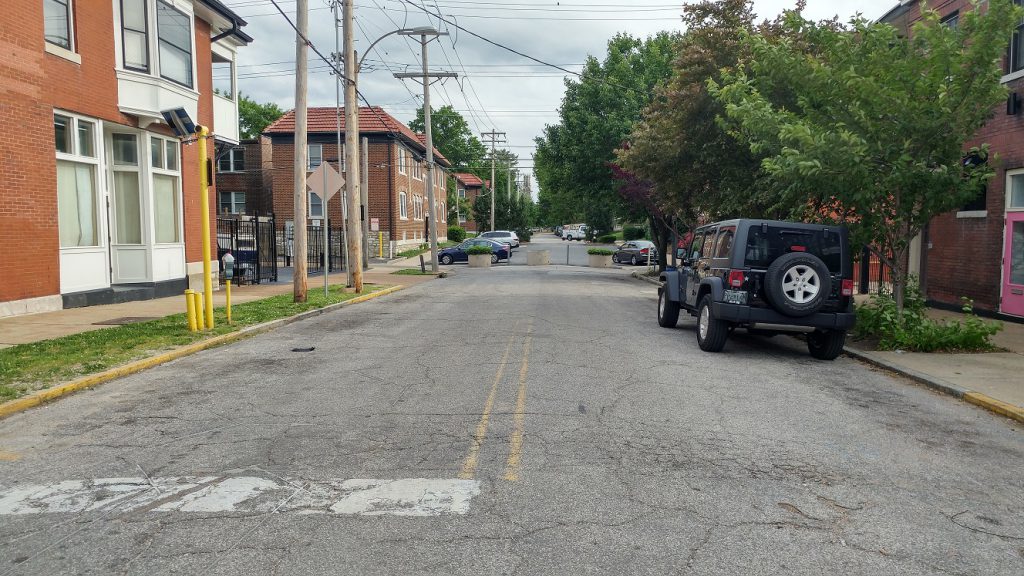 Rosedale is blocked south of Delmar
 Rosadale south of Delmar is a moonscape. It desperately needs to be repaved. Shame they couldn’t go a few feet into the side streets during the repaving of Delmar. Also the sidewalk repairs didn’t include the texture that the rest of the sidewalks have.
 The Everly and Delmar Hall. No word on possible occupants of th retail space in the Everly. The addition of 400 residents on Delmar will hopefully encourage some of the nearby properties to become active.
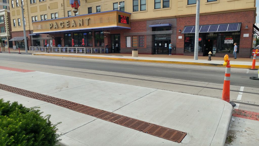
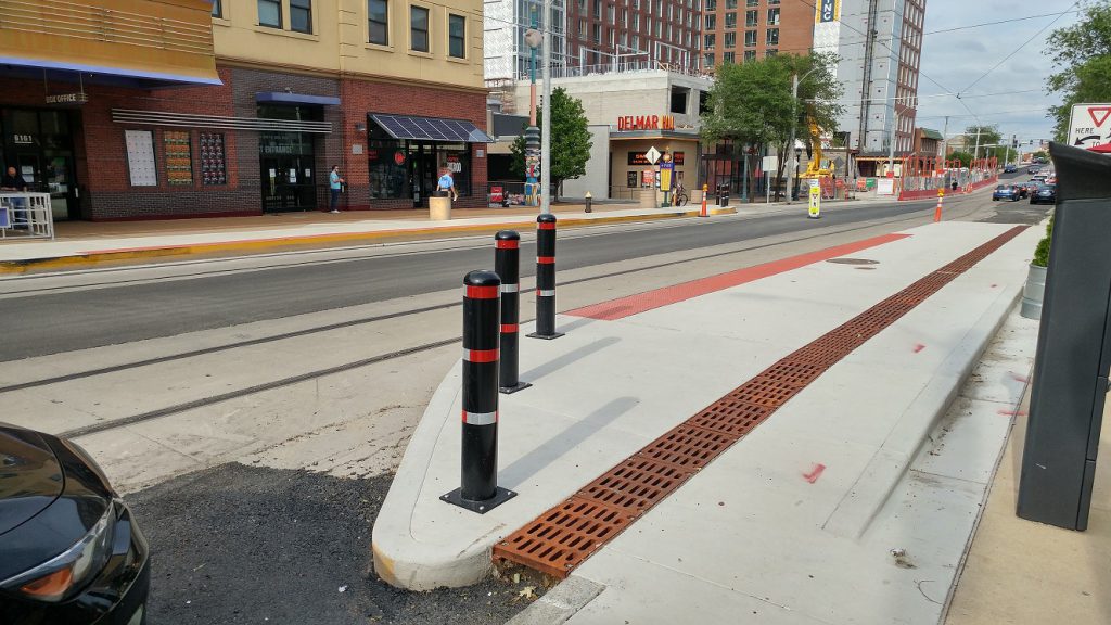 The Trolley stop at the Pageant. Poles are meant to keep jaydrivers off the platform. None of the stops on Delmar have seating or shelters. Hopefully that will come later.
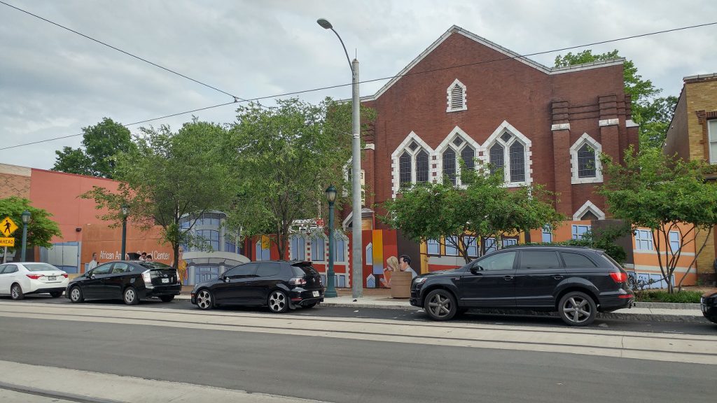 The fence in front of the former Mt. Olive Church has been up for 10? years. Joe Edwards purchased it and plans to bring it back to life. Hopefully the empty part to the east will get a 2-3 story building. The sidewalk in front is deteriorating. Its assessed value per acre is $504k.
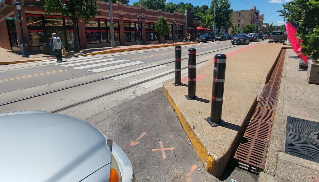
 OMG, the tracks are too close to the curb!
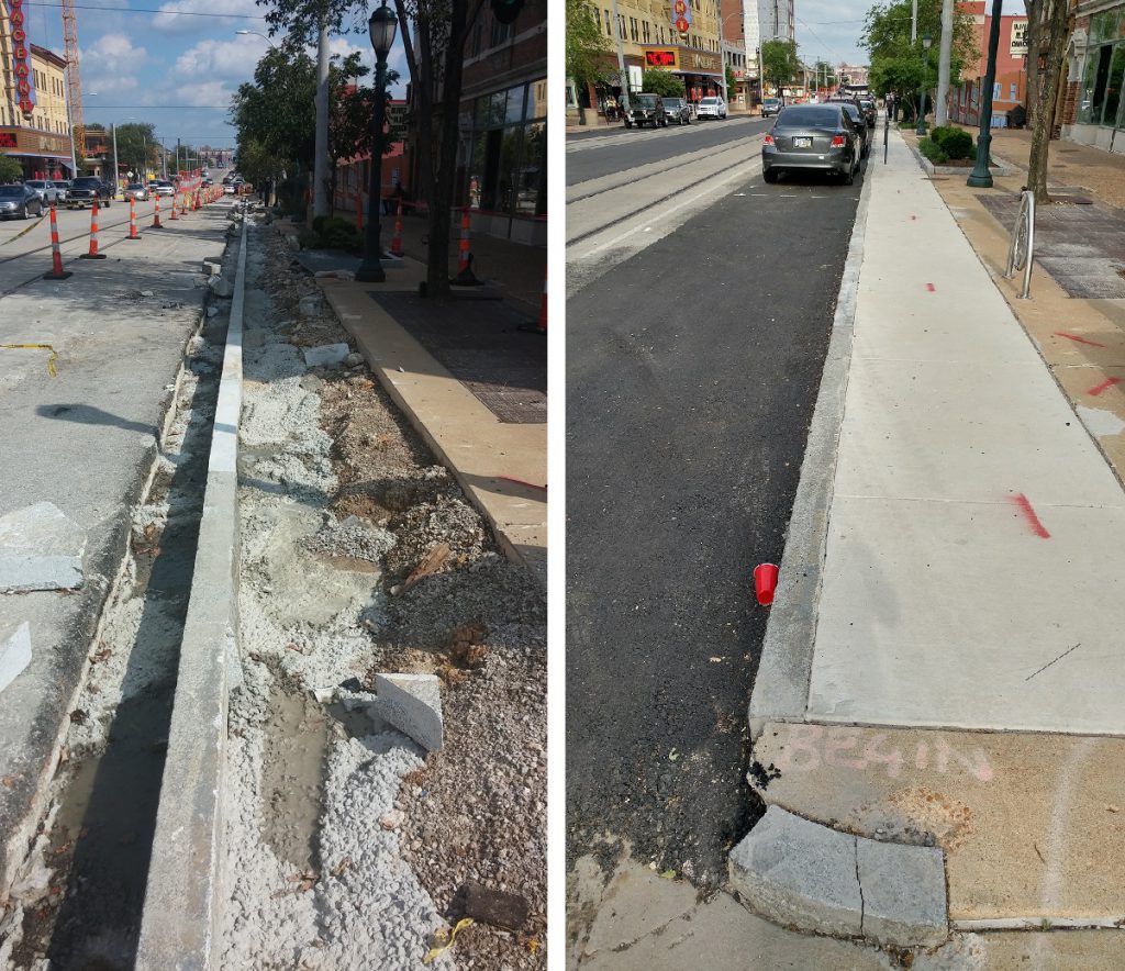 Operation Mirror Saver to the rescue!
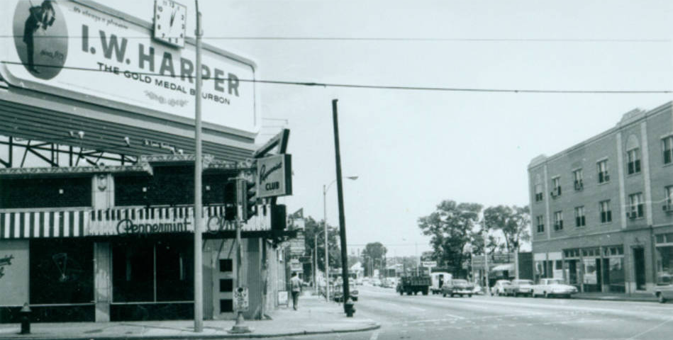
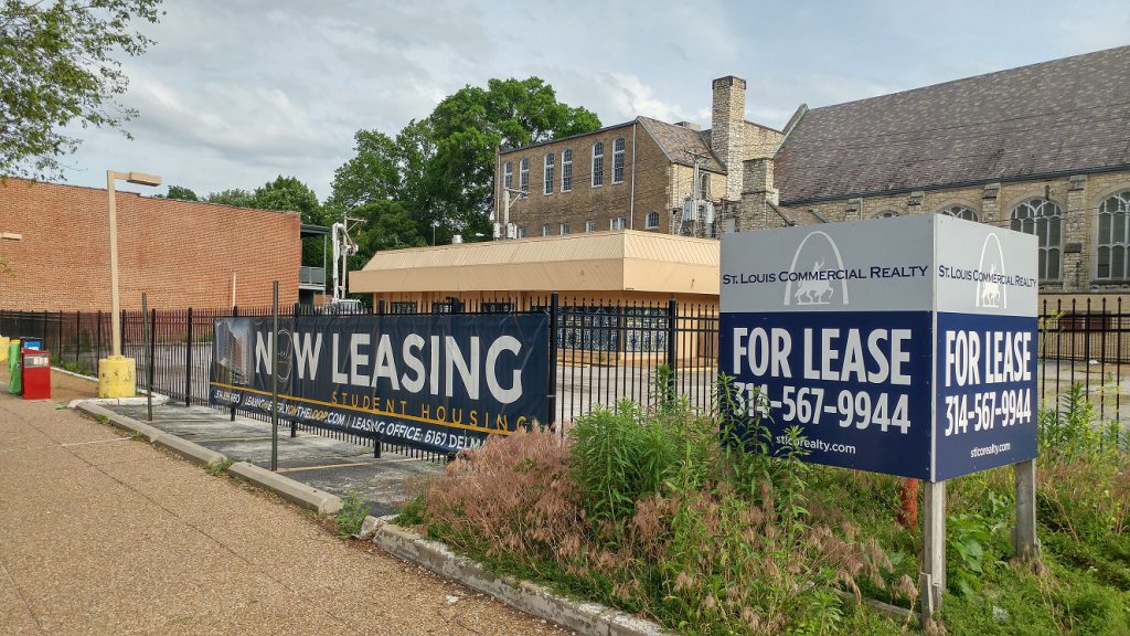 The blighting boarded-up low-productivity former fast food building at Delmar and Skinker. Closed for four years. Call now! It may become a Ferris wheel. Its assessed value per acre is $297k. The single-story Pinup Bowl across the street is $821k per acre.
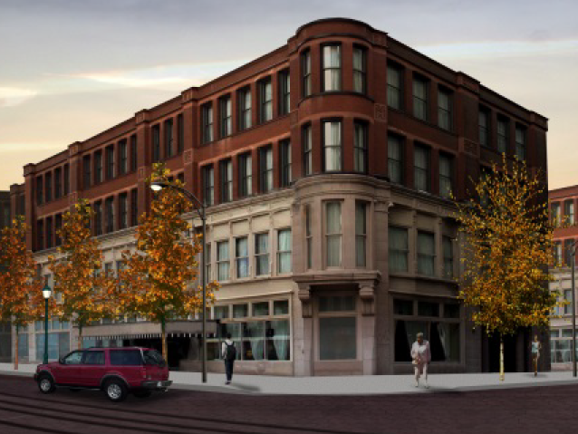 How about something like this?
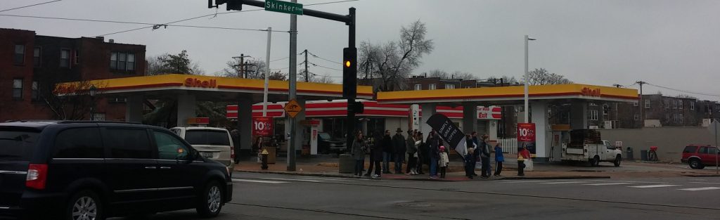 The northwest corner of Delmar and Skinker. The Shell Station’s assessed value per acre is $221k. Pace plans to redevelop it into a pharmacy and two floors of office space above. Pace has been granted eminent domain power to encourage Circle K to give up their lease. Removal of this vehicle magnet would improve walkability.
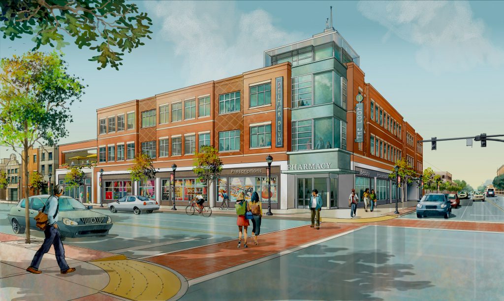
 What used to be at that corner.
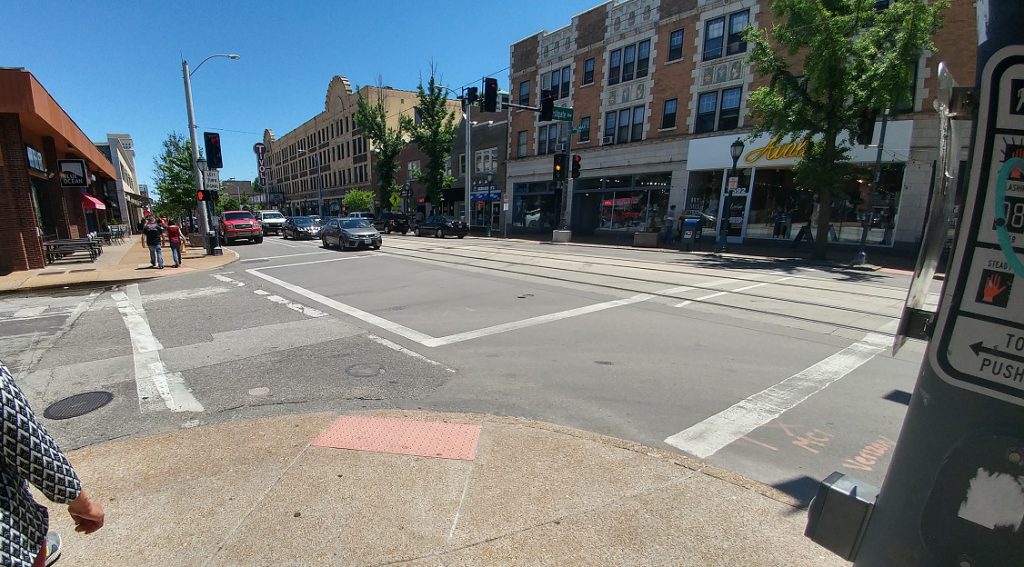
 The intersection of Skinker and Delmar. Just a year after its reconstruction the paint is fading. The curb cuts are in line with direction of travel. A goal of the trolley is to strengthen the east-west connection here so people view it as the same place. Development on any of the three nontraditional corners would help. The ferocity of traffic on Skinker will continue to be a hindrance.
 The barely used parking lot on the southwest corner of Skinker and Delmar. Word is that AT&T won’t sell it for security reasons. The site almost became a Jack-in-the-Box. Its assessed value per acre is $126k.
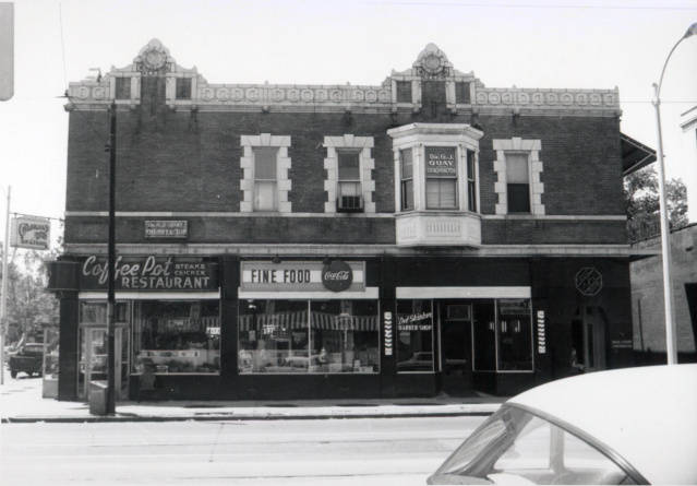 What used to be at 6200 Delmar. Despite being occupied it was deemed obsolete in the early 1970s.
 What used to be at 6208 Delmar.
 The AT&T building- tax exempt
 Another barely-used parking lot next to the AT&T building. Its assessed value per acre is $124k.
 Eastgate at Delmar. Crosswalks are missing.
 Awkward crosswalk on the north side of Eastgate and Delmar.
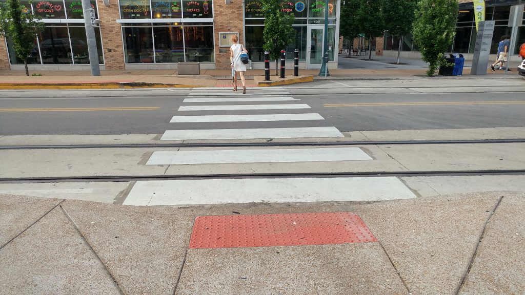 A crosswalk at Limit and Delmar. Before there were no crosswalks between the Tivoli and Skinker.
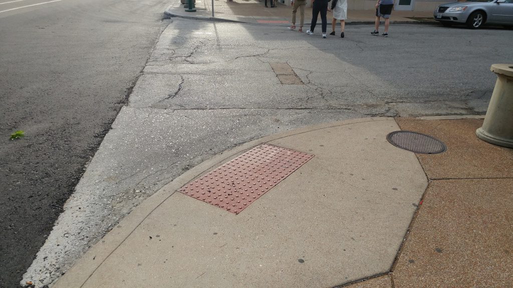
 The Delmar Loop Memorial Puddle and Sometimes Skating Rink has been vanquished! Bless the heart of whomever made this happen!
000